
Quick Read
- Hurricane Erin has intensified to a Category 4 storm, creating life-threatening rip currents along the U.S. Eastern seaboard.
- Five states, including North and South Carolina, are under rip current warnings through August 21.
- Caribbean islands are already experiencing severe flooding and power outages due to Erin.
- Bermuda lies in Erin’s direct path, with tropical storm-force winds expected later this week.
- Experts link Erin’s rapid intensification to warming ocean temperatures caused by climate change.
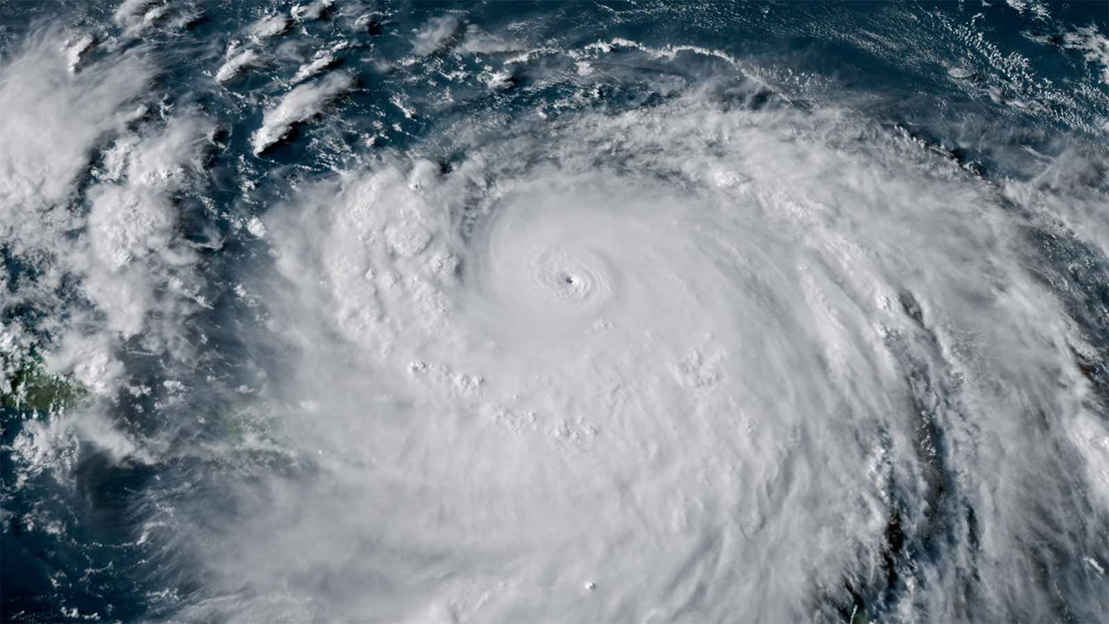
Hurricane Erin has rapidly intensified into a formidable Category 4 storm, creating a significant threat across the Eastern seaboard of the United States. Initially forming as a tropical storm, Erin underwent one of the fastest recorded intensifications in Atlantic hurricane history, reaching Category 5 status with sustained winds of 165 mph before stabilizing at its current Category 4 level. The storm’s expanded wind field now spans hundreds of miles, amplifying its potential for destruction far beyond its core.
Coastal States Brace for Dangerous Rip Currents
The National Weather Service (NWS) has issued a stern warning for dangerous rip currents and towering waves along the coasts of South Carolina, North Carolina, Virginia, Maryland, and New Jersey. Beginning Tuesday, August 19, these conditions are expected to persist through Thursday, August 21, posing severe risks to beachgoers. North Carolina’s Outer Banks region is particularly vulnerable, with Dare County officials declaring a local state of emergency and enforcing mandatory evacuations on Hatteras Island.
“This is not the week to swim in the ocean,” stated Dare County Emergency Management in their evacuation notice. Coastal flooding and ocean overwash are predicted to render portions of Highway 12 impassable, further complicating evacuation and emergency response efforts. According to Rolling Out, rip currents and surf-zone hazards have already claimed 44 lives in the U.S. this year, underscoring the deadly nature of these conditions.
Caribbean Islands and Bermuda Feel Erin’s Impact
While the U.S. East Coast prepares for Erin’s indirect effects, Caribbean islands are grappling with its immediate aftermath. Puerto Rico has experienced heavy rainfall and flash flooding, leaving 100,000 residents without power as of Sunday evening. The Turks and Caicos Islands and parts of the southeastern Bahamas have also reported significant rainfall, with forecasts predicting up to six additional inches in some areas. Risks of flash floods, landslides, and mudslides remain high.
Meanwhile, Bermuda lies directly in Erin’s projected path. The island is bracing for tropical storm-force winds and dangerously rough seas later in the week. Emergency preparedness measures are already underway as the storm continues its north-northeast trajectory between the U.S. coast and the Atlantic island.
Climate Change and Rapid Intensification
Hurricane Erin’s rapid escalation from a tropical storm to a Category 5 hurricane within just 24 hours has drawn attention to the role of climate change in fueling extreme weather events. Warmer-than-average sea surface temperatures in the Atlantic have provided the ideal conditions for Erin’s explosive growth. While these temperatures are not as record-breaking as those observed in 2023 and 2024, they remain significantly above historical norms.
Experts warn that Erin’s early-season intensity could signal a more active and severe hurricane period ahead. According to Rolling Out, forecasters are already tracking additional weather systems that could follow in Erin’s wake, amplifying the need for vigilance and preparedness as the Atlantic hurricane season enters its peak.
Safety Measures and Public Warnings
Authorities across affected regions are urging residents and visitors to heed all safety advisories. Beachgoers are strongly discouraged from entering the water, regardless of how calm conditions may appear from the shore. Local governments, including Dare County in North Carolina, have emphasized that the surf and flooding risks posed by Erin are life-threatening and should not be underestimated.
As communities along the Eastern seaboard prepare for Erin’s impacts, collaboration between local, state, and federal agencies is crucial to ensure public safety. With rip currents ranking among the leading weather-related causes of death in the U.S., public awareness and compliance with safety measures could save countless lives.
Hurricane Erin serves as a stark reminder of the power and unpredictability of nature. As the storm continues its path, the affected regions must remain vigilant, prioritizing safety and preparedness above all else.