
Quick Read
- A magnitude 6.0 earthquake struck the Moro Gulf region of the Philippines on January 28, 2026.
- The tremor occurred at a depth of 40 kilometers, with its epicenter located off Mindanao’s southern coast.
- The National Center for Seismology (NCS) reported the event at 12:17 pm IST (2:47 pm local Philippine time).
- The Philippines is situated on the seismically active Pacific Ring of Fire, a zone prone to frequent earthquakes and volcanic activity.
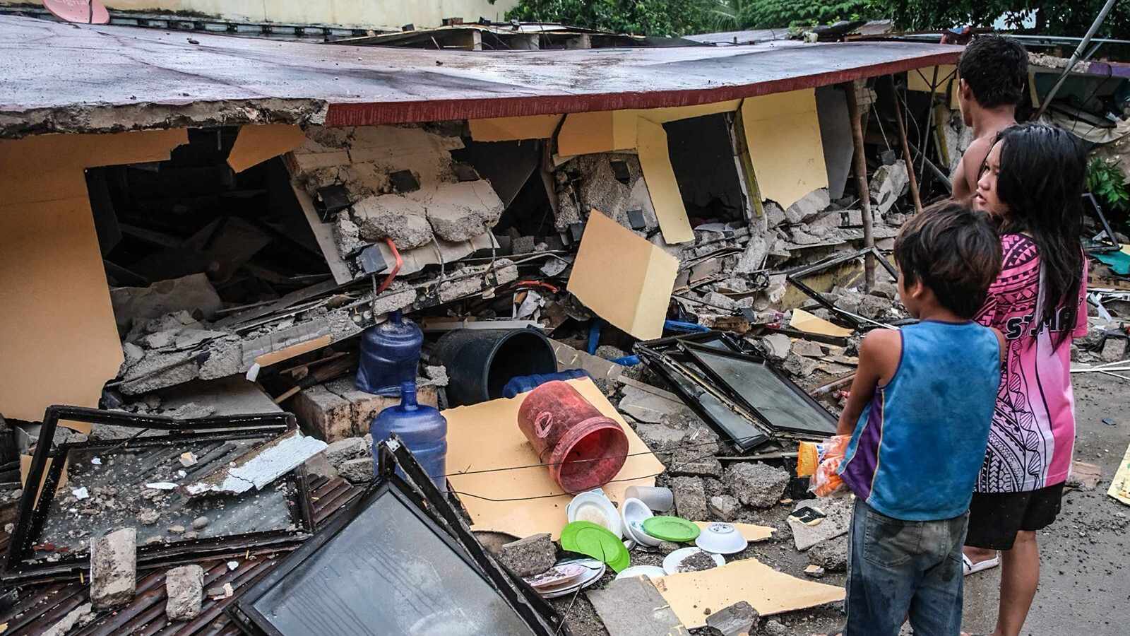
- No immediate reports of significant damage or casualties were available following the 6.0 magnitude quake.
MANILA (Azat TV) – A magnitude 6.0 earthquake struck the Moro Gulf region of the Philippines on Wednesday, January 28, 2026, prompting renewed attention to the nation’s precarious position along the highly seismically active Pacific Ring of Fire. The tremor, reported by the National Center for Seismology (NCS), occurred at a depth of 40 kilometers, with its epicenter located off the southern coast of Mindanao.
The earthquake was recorded at 12:17 pm IST (2:47 pm local Philippine time), according to the NCS. While the initial reports did not immediately detail significant damage or casualties, the event underscores the constant geological activity that characterizes the archipelago, which is frequently subjected to seismic events ranging from minor tremors to powerful quakes.
Details of the January 28 Quake
The National Center for Seismology confirmed the magnitude 6.0 tremor, specifying its coordinates at latitude 6.48° North and longitude 123.83° East, deep within the Moro Gulf. This offshore location is a known zone for tectonic activity. Preliminary assessments from other monitoring agencies, such as Indonesia’s Meteorology, Climatology, and Geophysical Agency (BMKG) and the European-Mediterranean Seismological Centre (EMSC), also indicated various seismic events of lesser magnitudes, including quakes of 4.9, 5.1, and 5.8, occurring on the same day in nearby regions, highlighting the pervasive seismic stress in the area.
Shallow earthquakes, generally defined as those occurring at depths less than 70 kilometers, are typically felt more intensely on the surface. While the 40-kilometer depth of this 6.0 magnitude quake is considered moderate, the potential for strong ground shaking remains a significant concern for coastal and island communities in the vicinity.
The Philippines: A Nation on the Pacific Ring of Fire
The Philippines’ susceptibility to frequent earthquakes and volcanic eruptions stems from its geographical location on the Pacific Ring of Fire, a vast horseshoe-shaped belt around the Pacific Ocean where several major tectonic plates meet. This zone is characterized by intense seismic and volcanic activity, with approximately 90% of the world’s earthquakes and 75% of its active volcanoes occurring there.
John Dale B. Dianala, an assistant professor at the National Institute of Geological Sciences at the University of the Philippines Diliman, explained to Al Jazeera that the nation stretches roughly 1,800 kilometers along the boundary of two major tectonic plates: the Philippine Sea Plate and the Eurasian Plate. These massive plates have been in continuous motion for millions of years, pushing against each other and gradually accumulating immense stress beneath the Earth’s surface.
Tectonic Stress and Potential for Tsunamis
Earthquakes are the result of this accumulated stress being suddenly released along fractures in the Earth’s crust, known as faults. The Philippines is crisscrossed by numerous active faults, both onshore and offshore. Dianala highlighted that vertical movement along offshore faults, such as the Philippine Trench, can displace large volumes of seawater, potentially generating tsunamis. Strong ground shaking can also trigger underwater landslides, further escalating tsunami risks to coastal areas.
While Wednesday’s 6.0 magnitude quake did not immediately trigger tsunami warnings, the geological context means that such a threat is always present in the region. Local authorities and residents are accustomed to regular earthquake drills and preparedness measures, reflecting the constant threat posed by the country’s dynamic geology. The absence of immediate reports of significant damage from this particular event serves as a testament to the resilience and preparedness measures in place, though vigilance remains paramount in such an active seismic zone.
The frequent occurrence of significant seismic events like the Moro Gulf earthquake underscores the critical importance of robust infrastructure, early warning systems, and continuous public education in the Philippines to mitigate the potential for widespread damage and loss of life.