
Quick Read
- Lake Effect Snow Warning is in effect for Ashtabula, Cuyahoga, Geauga, and Lake counties this weekend.
- Wind gusts up to 35 mph and several inches of snow are expected, especially Saturday night through Sunday.
- A quick burst of snow Saturday morning will be followed by a more widespread round in the afternoon.
- Arctic air will bring the coldest temperatures of the season, with wind chills falling below zero.
- Travel conditions may become hazardous due to blowing snow and rapidly changing weather.
Lake Effect Snow Warning: Northeast Ohio Braces for an Intense Winter Weekend
Winter is making itself known across Northeast Ohio. The National Weather Service has issued a Lake Effect Snow Warning for Ashtabula, Cuyahoga, Geauga, and Lake counties, signaling that the region is in for a challenging weekend. With wind gusts predicted up to 35 mph and several inches of snow expected, residents are being urged to prepare for rapidly changing conditions and dangerous cold.
What Does a Lake Effect Snow Warning Mean?
For many in Northeast Ohio, the phrase ‘lake effect snow’ is as familiar as the sound of snowplows in January. But each warning carries its own urgency. When cold, arctic air sweeps across the relatively warmer waters of Lake Erie, it picks up moisture and dumps it as heavy snow on the downwind shore. This weekend, that mechanism is poised to deliver multiple rounds of snow and biting cold to the region.
The warning comes as part of a broader suite of winter weather alerts. In addition to the Lake Effect Snow Warning, a Winter Storm Watch is in place for the same counties—Ashtabula, Cuyahoga, Geauga, and Lake—while a Winter Weather Advisory covers Carroll, Coshocton, and Tuscarawas counties, where 3 to 5 inches of snow are predicted.
Timing and Expected Snowfall: From Quick Bursts to Persistent Bands
According to the National Weather Service and reporting by Fox 8 Cleveland WJW, the wintry action begins early Saturday morning. A quick burst of snow showers will sweep from west to east across the region between 4AM and 10AM, bringing a coating to 2 inches of snow. While Friday itself will be cold but mostly dry—with highs only reaching the mid to upper 20s—conditions will deteriorate overnight as scattered snow showers develop after 4AM.
The second, more widespread round of snow will arrive Saturday afternoon, between 2PM and 10PM. This phase is expected to deliver the heaviest accumulations, especially south of Route 30, where more than 2 to 3 inches may fall. Closer to Lake Erie, snowfall totals during this round are forecast to reach up to an inch.
But the real story for the northern counties comes Saturday night, as lake effect snow bands intensify and persist through Sunday. The coldest air of the season so far will move in, with highs struggling to hit 20 degrees on Sunday and wind chills dropping below zero overnight. The combination of arctic air and moisture from the lake means that localized, intense snow bands could set up—making travel hazardous and conditions unpredictable.
Travel, Safety, and Community Preparedness
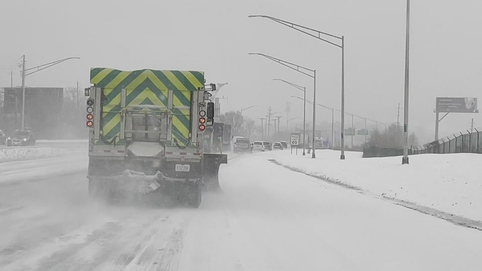
For those living and working in the warning area, the message is clear: plan ahead. Lake effect snow is notorious for its variability—one neighborhood may be buried under several inches, while another, just a few miles away, sees only flurries. This unpredictability is compounded by the forecasted wind gusts, which could reach up to 35 mph, blowing snow across roads and reducing visibility.
Authorities urge residents to check local forecasts regularly, keep emergency supplies in their vehicles, and allow extra time for travel. The cold itself will present dangers, especially for those without proper shelter or winter clothing. Subzero wind chills can lead to frostbite in minutes, making it vital to limit time outdoors and check on vulnerable neighbors.
Many schools and businesses are already monitoring the situation, prepared to adjust schedules as needed. Local road crews are on standby, ready to deploy plows and salt as conditions warrant. The community’s resilience has been tested by winter before, but each storm brings its own set of challenges.
Looking Ahead: When Will the Snow Let Up?
The current forecast suggests that snow showers will persist through Sunday, gradually tapering off as the arctic air mass moves eastward. The cold, however, will linger. Highs on Sunday are expected to remain below freezing, with the mercury barely reaching 20 degrees in some areas. Overnight lows in the 20s, combined with gusty winds, mean that the region will remain in a deep freeze for the foreseeable future.
Residents are encouraged to stay informed by downloading weather apps or tuning in to local outlets like Fox 8 Cleveland, which will provide updates as the situation evolves. The unpredictability of lake effect snow means that conditions can change rapidly, and the most prepared communities are those that stay alert and adaptable.
For now, Northeast Ohio is bracing itself—not just for another winter storm, but for the unique intensity that lake effect snow can bring. Whether it’s the howling wind, the swirling snow bands, or the bone-deep chill, this weekend will be a test of endurance and preparedness for everyone in the warning area.
Assessment: The Lake Effect Snow Warning for Northeast Ohio is a textbook case of how geography and weather can combine to create highly localized but severe winter hazards. With arctic air fueling persistent snow bands, the next 48 hours will demand vigilance from residents, emergency crews, and local officials alike. This is not just another winter weekend—it’s a reminder of how quickly nature can change the rhythm of daily life, and why preparedness is always essential in the snow belt.