
Quick Read
- Winter storm warnings issued for the Upper Midwest, including Minnesota, Montana, and North Dakota.
- Up to 18 inches of snow expected in parts of Minnesota, with localized totals over 24 inches possible.
- Storm intensified into a “bomb cyclone,” bringing high winds and hazardous conditions.
- Multiple North Dakota counties are under no travel advisories due to heavy snow, ice, and reduced visibility.
- The storm is moving eastward, with significant lake-effect snow and ice accumulation expected in the Great Lakes and Northeast.
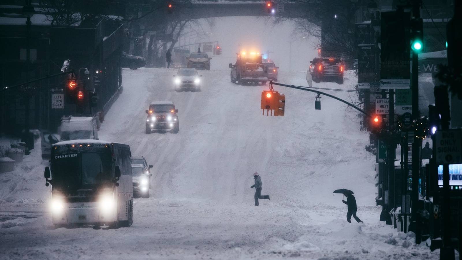
FARGO, North Dakota (Azat TV) – A potent winter storm has brought heavy snow, ice, and high winds across the Upper Midwest, prompting widespread winter storm warnings and travel advisories as it intensifies and moves eastward. The National Weather Service (NWS) has reported that the system, which developed into a “bomb cyclone” earlier in the week, is expected to deliver significant snowfall, with some areas anticipating well over a foot of snow, posing hazardous conditions for millions across several states.
Winter Storm Intensifies Across Upper Midwest
The storm’s initial impact has been felt most acutely across parts of the Upper Midwest, with blizzard warnings issued for northeastern Minnesota and eastern Montana, effective from Tuesday afternoon through Thursday morning, February 17-19. Forecasters from the Weather Prediction Center indicate that portions of northeastern Minnesota could see snowfall totals ranging from 10 to 18 inches, with localized amounts potentially exceeding 24 inches. Easterly wind gusts up to 60 mph are also expected, creating whiteout conditions, particularly along Minnesota’s North Shore, according to USA Today.
In eastern Montana, lighter snowfall is anticipated, but gusts up to 55 mph are still expected to create dangerous whiteout conditions. Meanwhile, multiple counties in northeast North Dakota, including Pembina, Walsh, Grand Forks, Nelson, Griggs, and Steele, are currently under no travel advisories due to slippery roads, icy conditions, reduced visibility, and blowing snow, as reported by Valley News Live. Forecasts for these areas predict 5 to 10 inches of snow, with locally higher amounts possible, accompanied by an ice glaze and wind gusts up to 40 mph.
Eastward Trajectory and Broader Impacts
As the winter storm progresses, its effects are extending into the Great Lakes region and beyond. The system, which rapidly intensified into a “bomb cyclone” as measured by a sharp decrease in atmospheric pressure over 24 hours, is expected to bring blizzard conditions, lake-enhanced snow, and an icy mix of freezing rain to areas east of the Great Lakes. Moderate to high probabilities support snowfall totals exceeding 6 inches in parts of the Upper Midwest, particularly near Lake Superior, and extending into northern Wisconsin and Michigan’s Upper Peninsula.
A corridor of freezing rain and significant ice accumulation is possible from Minnesota to northern Michigan, with localized amounts exceeding one-quarter inch in parts of northern Michigan. Further east, a surge of cold air behind the front is expected to generate significant lake-effect snowfall downwind of Lake Erie and Lake Ontario, with some areas potentially seeing 2 to 4 feet of snow over the coming days. The NWS Weather Prediction Center also warns of snow squalls impacting travel across the Lower Great Lakes and moving through the Ohio Valley and interior Northeast.
Travel Disruptions and Official Warnings
The widespread nature of the storm has led to numerous winter weather alerts and warnings across the eastern U.S. Metropolitan areas in the storm’s path include Detroit, Pittsburgh, Philadelphia, Washington, D.C., Buffalo, Syracuse, New York City, and Boston. Interior parts of New England should prepare for ice accumulation, with up to an inch possible in certain locations, according to AOL News.
New York state emergency officials have warned of snowfall rates as high as 3 inches per hour in the heaviest snowbands, with “near blizzard-like conditions” possible across counties such as Wayne, Cayuga, Onondaga, Oneida, and Madison. New York Governor Kathy Hochul urged residents in impacted areas to “avoid all unnecessary travel, follow the direction of local authorities, and telecommute whenever possible.” Millions were initially under various winter weather alerts as the storm moved eastward, with current alerts focusing on areas south and east of Lake Ontario and Lake Erie, including winter storm warnings for parts of western New York.
The rapid intensification and broad geographical reach of this winter storm highlight the complex and challenging nature of severe weather events, prompting extensive preparations and warnings to mitigate widespread disruptions and ensure public safety across multiple U.S. regions.