
Quick Read
- Tornado warnings and severe thunderstorms impacted Oklahoma Thursday night and early Friday.
- Confirmed tornadoes were reported near Helena, Alfalfa County, Oklahoma.
- Threats included golf ball-sized hail and 60 mph wind gusts across multiple counties.
- A significant risk of severe storms and tornadoes is forecast to continue across central and eastern Oklahoma on Friday afternoon and evening.
- The tornado index has risen to 6 out of 10 in eastern Oklahoma for Friday.
OKLAHOMA CITY (Azat TV) – Oklahoma is bracing for a continued threat of severe weather and potential tornadoes throughout Friday, March 6, 2026, following an intense night of confirmed tornado touchdowns and widespread warnings across the state. The National Weather Service (NWS) and local meteorologists have indicated that while the immediate early morning warnings are expiring, a significant risk for new, strong storms is expected to develop in central and eastern Oklahoma later in the day, demanding ongoing vigilance from residents.
The severe weather outbreak began Thursday evening, bringing multiple tornado and severe thunderstorm warnings that tracked across western and central Oklahoma. Throughout Thursday night and into early Friday morning, communities faced threats ranging from confirmed tornadoes to golf ball-sized hail and destructive wind gusts up to 60 mph. These storms led to immediate precautions in numerous counties as residents were urged to seek shelter.
Thursday Night’s Intense Tornado Activity Across Oklahoma
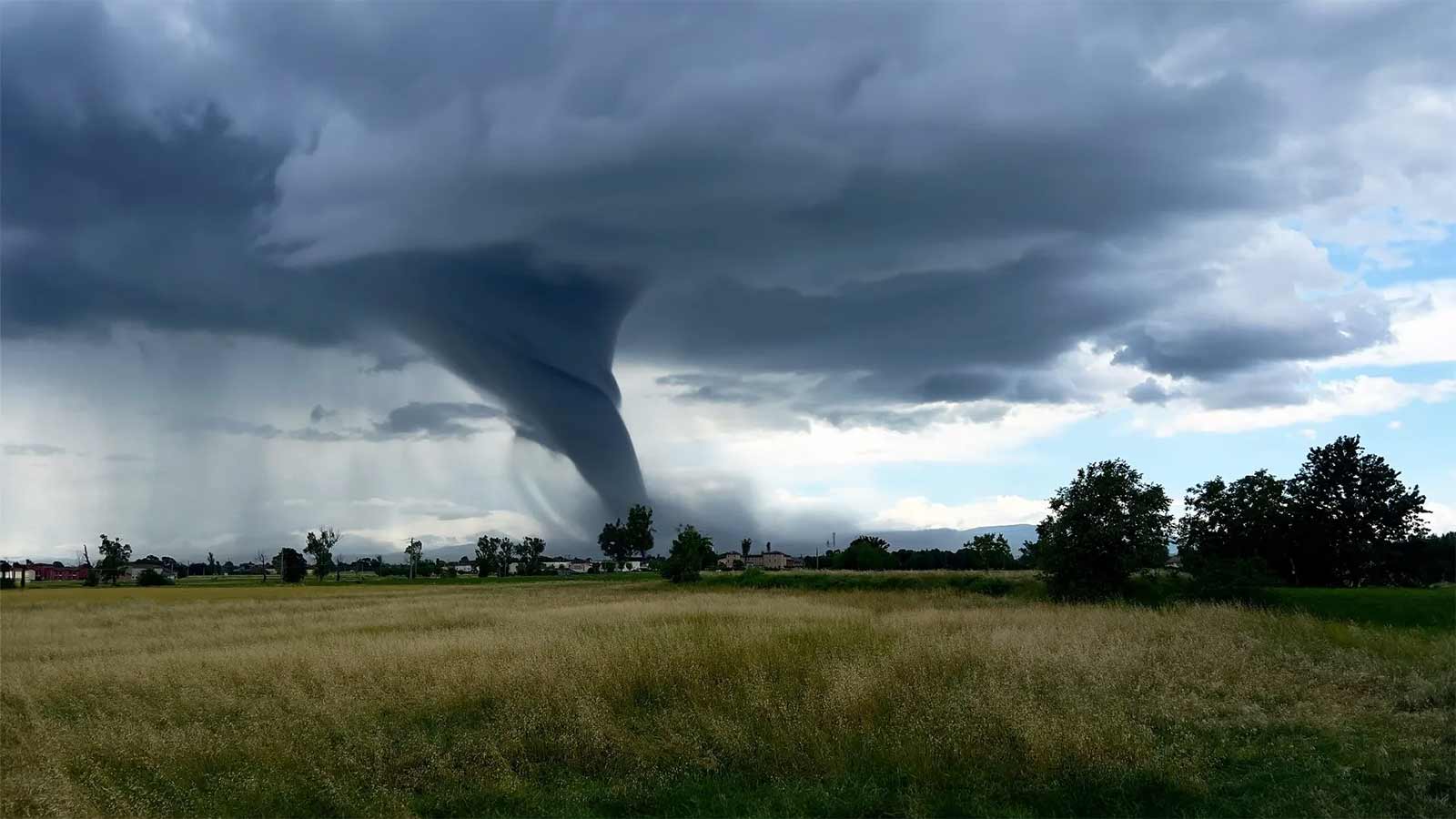
Thursday night saw a flurry of severe weather activity, particularly in western and north-central Oklahoma. The National Weather Service issued multiple tornado warnings, with confirmed touchdowns reported. One particularly dangerous tornado was located near Helena in Alfalfa County at 9:32 p.m. Thursday, prompting urgent warnings for Helena, Jet, and Great Salt Plains Lake, according to KOCO 5. Other tornado warnings were in effect for areas including Grant County (near Wakita and Renfrow), Roger Mills County (near Berlin and Dempsey), and Beckham County (near Erick and Texola).
Accompanying these tornado threats were numerous severe thunderstorm warnings. These storms brought significant risks of large hail, with reports of ping-pong to half-dollar sized hail impacting areas such as Woods, Major, Dewey, Custer, and Roger Mills counties. Wind gusts up to 60 mph were a consistent threat, causing concern for property damage and hazardous conditions. KOCO 5 Storm Chaser Jason Hill captured video of tornado damage near Jet, underscoring the severity of the nocturnal events.
Oklahoma Braces for Continued Tornado Risk on Friday
As Friday progresses, Oklahoma is not expected to see a full reprieve from severe weather. KOCO 5 Chief Meteorologist Damon Lane stated that rounds of storms are anticipated again during the day on Friday. Meteorologist Jonathan Conder added that after a morning lull, severe weather is expected to redevelop in the late afternoon and evening, shifting its primary focus eastward.
The forecast for Friday includes an enhanced risk (Level 3) for central and eastern Oklahoma, including the Oklahoma City metro area. The tornado index for these regions has increased significantly to 6 out of 10 in areas near Seminole, Stillwater, Ponca City, Bartlesville, and Tulsa, with a 4 out of 10 index for the OKC metro and surrounding central and southern areas. These anticipated storms also carry the potential for large hail and damaging winds, similar to the threats experienced on Thursday night. Residents in these areas are advised to stay updated on weather alerts and have emergency plans in place.
The ongoing severe weather threat underscores the volatile nature of Oklahoma’s spring storm season, requiring continuous public awareness and rapid response to evolving weather patterns as meteorologists track these dynamic systems.