
Quick Read
- Severe thunderstorm warnings issued across New Hampshire, Massachusetts, Maine, and New York.
- Storm threats include 60-mph winds, hail, torrential rain, and potential tornadoes.
- Residents are urged to monitor weather updates and take shelter if necessary.
- Cooler, drier weather expected to settle in overnight after storms dissipate.
The northeastern United States is bracing for a wave of severe thunderstorms on Saturday, September 6, 2025, with warnings issued across New Hampshire, Maine, Massachusetts, and New York. The National Weather Service (NWS) has highlighted threats including damaging winds of up to 60 mph, hail, torrential rain, and even the potential for brief tornadoes. Residents in affected areas are being urged to remain vigilant and take immediate precautions to ensure their safety.
Wide-Reaching Warnings Across the Region
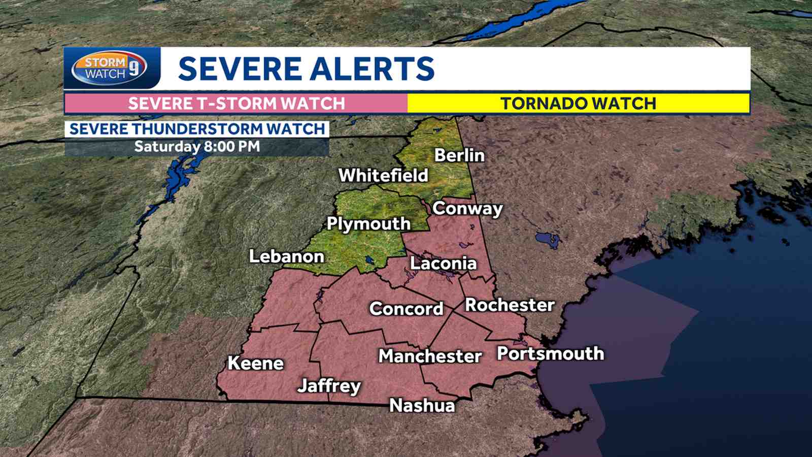
On Saturday afternoon, severe thunderstorm warnings were issued for multiple counties across New Hampshire, including Rockingham, Hillsborough, Merrimack, Carroll, and Sullivan counties, according to WMUR. The warnings are expected to remain in effect until the early evening, with storm activity likely diminishing by 7 p.m. The storms carry the risk of localized flooding due to heavy rainfall in a short period, as well as lightning and hail.
In Massachusetts, the situation is equally concerning. As per WCVB, the NWS issued severe thunderstorm warnings for Worcester, Hampshire, Franklin, and Hampden counties earlier in the day. StormTeam 5 labeled Saturday as an ‘Alert Day,’ cautioning residents about the possibility of multiple tornadoes that have already been reported in some areas. The storms began forming west of the state after 1 p.m. and have been moving eastward steadily.
Precautionary Measures for Residents
Residents across the affected regions are being strongly advised to monitor weather updates and take proactive steps to stay safe. According to WMTW, the NWS recommends having multiple ways to receive alerts, such as weather radios, mobile apps, or local broadcasts. Key safety measures include seeking shelter in a sturdy building away from windows, avoiding flooded roads, and delaying travel unless absolutely necessary.
Lightning, high winds, and hail pose significant risks. If a severe thunderstorm warning is issued, residents should immediately move to an interior room on the lowest floor of their home, such as a basement or bathroom, to avoid potential injuries from shattered glass or falling debris.
What to Expect After the Storm
The severe weather is expected to subside as the evening progresses. Cooler and drier air will begin settling into the region overnight, offering some relief after a day of intense conditions. According to Fox 5 NY, the storm system is expected to pull away by Sunday morning, leaving behind a clearer and more stable weather pattern. Temperatures are forecasted to range between the mid-60s and mid-70s next week, providing a comfortable transition into the fall season.
However, forecasters caution that residual showers may linger in southern and coastal areas of New Hampshire and Massachusetts into Sunday morning. Partial clearing is anticipated by the afternoon, allowing residents to resume normal activities.
Why This Matters
Severe thunderstorms are a reminder of the unpredictable and potentially hazardous nature of late summer weather in the Northeast. Events like these highlight the importance of preparedness and timely communication from meteorological agencies. With climate patterns becoming increasingly erratic, residents and local governments alike must remain vigilant to minimize risks and ensure community safety.
The current wave of severe thunderstorms underscores the critical need for awareness and preparedness during extreme weather events. Residents are advised to stay tuned to local weather updates and prioritize safety above all else.