
Quick Read
- A major winter storm is forecast to impact over half of the U.S. this weekend with heavy snow and ice.
- Snow accumulations of 1-2 feet are expected in a 1,000-mile swath across cities like Oklahoma City, Nashville, and Washington D.C.
- A hazardous ice storm is predicted for Dallas, Shreveport, Jackson, and Atlanta.
- New England will experience an Arctic outbreak with the coldest temperatures in several years, including sub-zero morning lows.
- Arizona anticipates a cold front bringing widespread rain and snow above 7,000 feet, with temperatures dropping to the mid-60s over the weekend.
A formidable winter storm is expected to sweep across more than half of the United States this weekend, unleashing a potent combination of heavy snow, a dangerous ice storm, and a severe Arctic outbreak. While central and eastern regions brace for significant impacts, including potential record-setting cold in New England, Arizona is also preparing for a distinct shift in weather, transitioning from mild conditions to a cold front bringing rain and high-elevation snow.
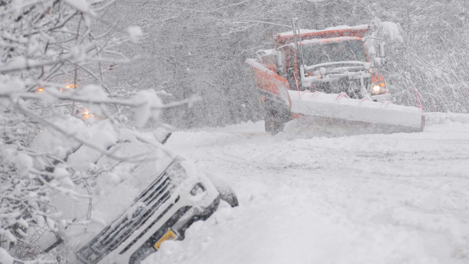
Widespread Winter Storm Threatens Central and Eastern U.S.
Forecasters are tracking a ‘monster storm’ forming from two merging atmospheric energy systems, one currently west of Alaska and another off the California coastline, according to CBS News. This powerful system is projected to create a swath of heavy snow stretching approximately 1,000 miles, with accumulations potentially reaching 1 to 2 feet. Cities currently identified within this ‘jackpot zone’ for heavy snowfall include Oklahoma City, Little Rock, Nashville, Charlotte, North Carolina, and Washington D.C.
Just south of the anticipated snow zone, an even more hazardous scenario is unfolding: a major ice storm. This icy threat is currently forecasted for cities such as Dallas, Shreveport, Louisiana, Jackson, Mississippi, and Atlanta. Residents in these areas are advised to prepare for extremely dangerous travel conditions, power outages, and potential tree damage due to the accumulation of ice.
As of Wednesday, January 21, forecasters are in the ‘mid-range’ portion of the prediction window, meaning while the broad impact is clear, specific storm tracks and localized accumulations may still fluctuate. The National Weather Service and most weather models are currently highlighting the Mid-Atlantic area and points just south for maximum impact, though New England is not entirely out of the woods for a major winter storm later Sunday and early next week.
Arctic Blast Grips New England
Accompanying the widespread winter storm, an intense Arctic airmass originating directly from the North Pole is set to settle over New England late Friday and persist through the weekend. This will bring the coldest temperatures of the season, and potentially the coldest in several years, to the region. Daytime highs on Saturday and Sunday are expected to range from single digits to teens across most of southern New England. Morning lows will largely fall below zero north and west of Boston, with single digits along the coast and to the south.
These extreme cold temperatures pose significant risks, including frostbite and hypothermia, for anyone exposed to the elements for extended periods. Residents are urged to take all necessary precautions to stay warm and safe, including limiting outdoor exposure, wearing multiple layers of clothing, and ensuring heating systems are functioning properly.
Arizona Prepares for Weekend Front
In contrast to the severe winter conditions gripping other parts of the country, Arizona has been experiencing mild weather, with Phoenix anticipating a high of 73 degrees on Wednesday and 74 degrees on Thursday, accompanied by partly to mostly cloudy skies and light winds, as reported by FOX 10 Phoenix. However, this period of pleasant weather is set to end as a significant change arrives by Friday.
An area of low pressure and an associated cold front will slide into Arizona from the south on Friday, bringing increasing chances of rain across the state, particularly by the evening. Southern Arizona is expected to see precipitation first, which will then extend into northern and especially eastern Arizona. As colder air settles in, rain chances will transition to snow chances over the highest elevations on Friday evening. By Saturday, with a secondary system dropping into the state, the likelihood of snow increases for areas above 7,000 feet. The Valley is also expected to receive additional rain, which could be heavy at times, through Saturday.
Over the weekend, winds will increase, creating breezy to windy conditions, and temperatures will drop notably. Forecast highs in the Valley are expected to slip from the low 70s through Friday to the mid to upper 60s. By Sunday, the state is expected to clear, with dry and sunny conditions returning, and temperatures rebounding into the low to mid-70s next week.
Localized Snow in Michigan and Comprehensive Safety Advisories
Meanwhile, Livingston County in Michigan is also experiencing winter weather, with forecasters predicting a high of 31 degrees on Wednesday, feeling more like 16, and an overnight low of 19 degrees. Cloudy skies with occasional snow and flurries are expected, accumulating up to an inch, with a storm total of 1 to 2 inches, potentially leading to slippery roads, according to the Livingston Daily.
Given the diverse and challenging weather conditions across the nation, authorities are issuing comprehensive safety advisories. The Arizona Department of Transportation (ADOT) reminds drivers heading to snowy high country areas to never park along highway shoulders for snow play, as this creates hazardous conditions for other drivers and interferes with first responders. ADOT recommends packing essentials such as warm clothing, blankets, a fully charged mobile phone, flashlight, drinking water, healthy snacks, a first-aid kit, ice scraper, a small bag of sand or kitty litter for traction, a small folding shovel, travel tool kit, battery cables, and safety flares. Drivers are also urged to prepare their vehicles for wintry conditions, including checking fuel levels (at least half to three-quarters full), using snow tires or chains if required, and ensuring all lights and defrosters are working.
The American Red Cross also provides critical tips for heavy rain, flood, and severe thunderstorm safety. For flooded roadways, the message is clear: ‘Turn around, don’t drown.’ If caught in rising waters, exit the car quickly and move to higher ground. In flood-prone areas, be prepared to evacuate and follow official orders. During power outages, use flashlights instead of open flames. For thunderstorms, the Red Cross advises assembling an emergency kit, knowing community evacuation plans, creating and practicing a household disaster plan, and having a battery-powered or hand-crank radio. It also recommends identifying a safe place in the home, away from windows, for family members to gather.
The confluence of a major winter storm impacting a vast portion of the country and distinct regional weather shifts, such as Arizona’s impending cold front, underscores the dynamic and varied nature of winter weather systems across the United States. This scenario highlights the critical importance of localized, up-to-date forecasts and comprehensive preparedness measures, as different regions face unique and significant weather-related hazards simultaneously.