
Quick Read
- The USGS officially downgraded the April 2 Boulder Creek earthquake from 5.1 to 4.6 magnitude.
- Seismologists are continuing to analyze regional data to refine the seismic profile of the event.
- Authorities remain on alert for potential aftershocks, which can occur days or weeks following the initial tremor.
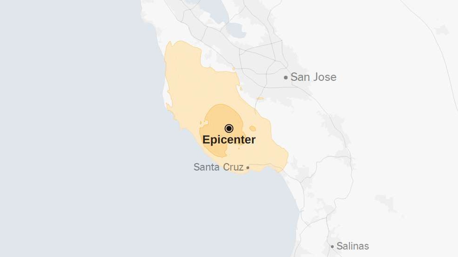
BOULDER CREEK (Azat TV) – A seismic event near Boulder Creek, California, has undergone a downward revision by federal authorities, following initial reports that suggested a more significant impact. The United States Geological Survey (USGS) confirmed on Friday that the earthquake, which struck the region at 1:41 a.m. Pacific time on April 2, 2026, registered a magnitude of 4.6.
Refining Seismic Data After Initial Estimates
The adjustment follows an earlier assessment by the USGS that placed the temblor at a 5.1 magnitude. According to the agency, such revisions are standard practice as seismologists synthesize incoming data from regional monitoring stations to produce a more precise profile of the event. The agency noted that scientific teams continue to analyze the shake-severity maps to better understand the crustal movement beneath the Central Coast.
Monitoring Ongoing Aftershock Risks
While the immediate threat from the primary event has passed, the focus has shifted to the potential for aftershocks. The USGS defines these as smaller seismic adjustments that occur along the same fault line following an initial rupture. Residents in the affected area are being advised that these secondary tremors can occur days or even weeks after the main event. While typically lower in intensity, the agency maintains that aftershocks can still impact structures already weakened by the initial movement.
The Role of Data Accuracy in Public Safety
The discrepancy between the initial 5.1 estimate and the final 4.6 figure underscores the challenges of real-time seismic reporting. The USGS relies on automated systems that provide instantaneous data, which is then verified by human analysts. This iterative process is critical for emergency management agencies, as it ensures that resource deployment remains proportionate to the actual intensity of the seismic activity. The current review of the Boulder Creek area remains ongoing, with data being aggregated from all sensors within a 100-mile radius to track any subsequent seismic instability.
The revision of the magnitude serves as a reminder that the immediate aftermath of a seismic event is a dynamic period where data precision is prioritized over speed, ensuring that emergency responses are based on verified geological realities rather than initial automated projections.