
LONDON (Azat TV) – The United Kingdom is bracing for the arrival of Storm Chandra, named by the UK Met Office, which is expected to bring severe winds, heavy rain, and snow across much of the country on Tuesday. This marks the third major storm to impact the UK this month, following Goretti and Ingrid, significantly heightening the risk of widespread flooding and disruption in areas already grappling with saturated ground and weakened infrastructure.
Amber Warnings Issued Amid Broad Disruption Threat
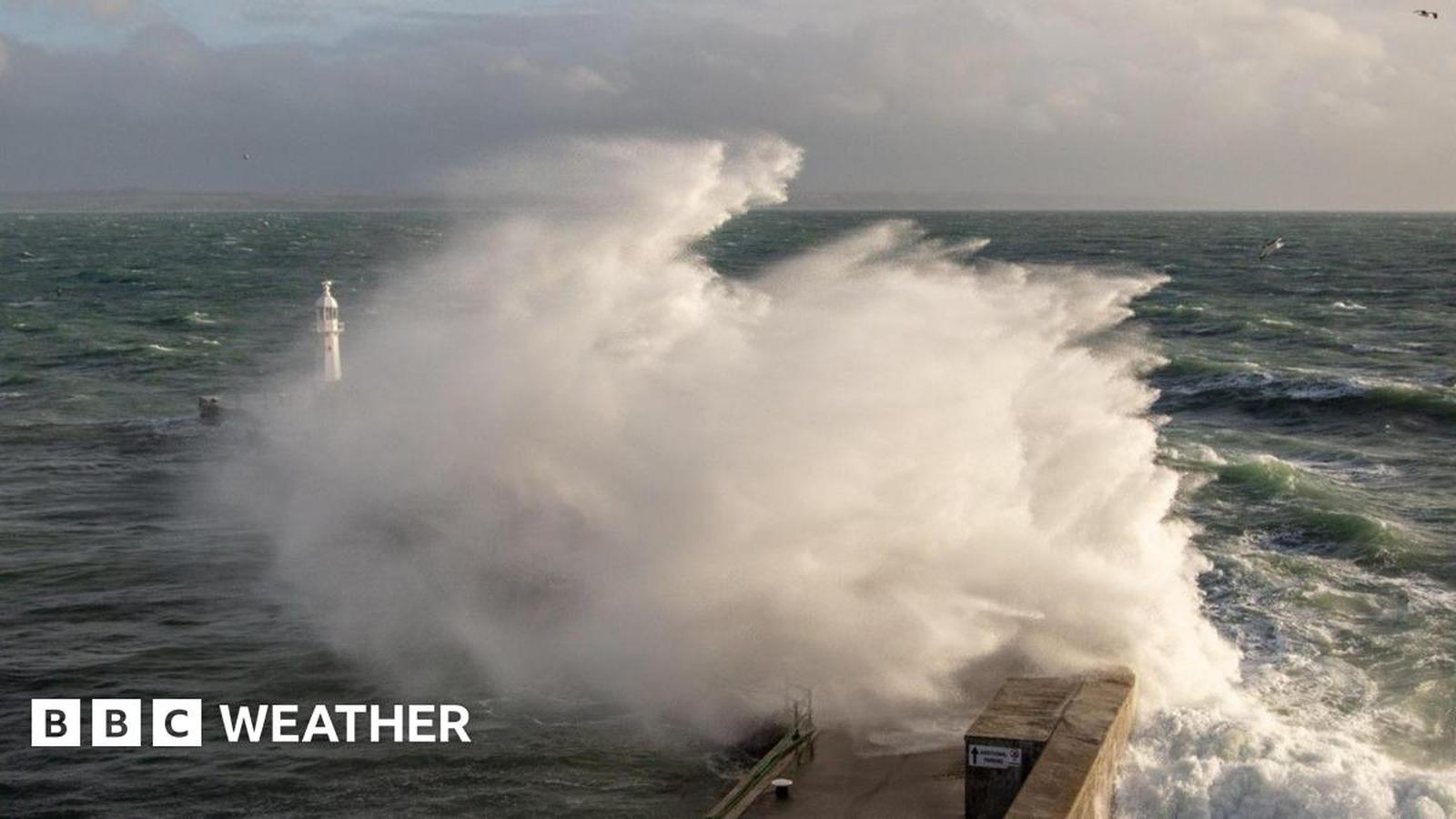
The Met Office has issued several severe weather warnings, including two amber alerts, signaling a high likelihood of significant impacts. An amber wind warning has been declared for eastern parts of Northern Ireland, valid from 05:00 to 21:00 on Tuesday. Winds are forecast to escalate, with coastal gales and severe gusts potentially reaching up to 75 mph (120 km/h). These powerful winds are expected to generate large coastal waves, which are likely to overtop sea walls and promenades.
Concurrently, an amber warning for heavy rain is in effect for south-west England, commencing at 17:00 on Monday and lasting until 09:00 on Tuesday. Forecasters predict 30-50mm of rainfall across wide areas, with higher ground, particularly south Dartmoor, potentially experiencing 60-80mm. Given the recent persistent wet weather, this additional rainfall poses a substantial risk of flooding as it falls on already saturated ground.
Beyond the amber warnings, numerous yellow warnings have been issued across the UK. These cover persistent rain and flood risk in Northern Ireland, south-west England, Wales, parts of central southern England, London, and the south-east. Additionally, yellow warnings for damaging winds, heavy rain, and hill snow are in place for various regions including Northern Ireland, south-west England, West Wales, hilly areas of central and northern England, and parts of Scotland. Up to 5cm of snow is expected on hills around 300 meters, with 10-20cm above 500 meters in Scotland, accompanied by brisk winds causing drifting and reduced visibility.
The anticipated impacts of Storm Chandra are extensive and could include significant delays or cancellations to air, sea, and rail travel, widespread spray and flooding on roads, interruptions or damage to power supplies, and the flooding of homes and businesses. There is also a risk that some communities could be cut off by flooded roads, and trees may be damaged or blown down, particularly where vulnerable from previous storms. Landslides are also possible in prone locations.
Cumulative Impact Heightens Flood and Wind Risk
What makes Storm Chandra particularly concerning is its arrival hot on the heels of Storms Goretti and Ingrid. These preceding systems have left much of the UK’s ground saturated and many structures, trees, and power lines vulnerable. Met Office Chief Forecaster Paul Gundersen highlighted this cumulative effect, stating that strong winds would initially impact the Isles of Scilly, western Cornwall, and southwest Wales, which are ‘still vulnerable after Storm Goretti,’ with gusts of 70 to 80mph possible in these areas. He further noted that ‘heavy rain is an additional hazard as it falls on saturated ground in Dorset and southern parts of Devon, Somerset and Cornwall.’
The continuous downpours from these successive storms have left little time for water to drain away or rivers to fully recover, thereby significantly elevating the flood risk. The wind threat is also exacerbated, as infrastructure and natural landscapes have already been battered this month. Local authorities continue search efforts in areas previously affected by severe weather, including a missing kayaker in Devon and the recovery of a body thought to be one of two swimmers who went missing on Christmas Day, underscoring the already precarious conditions.
Understanding Storm Naming and Public Guidance
Storms are named in the UK by the Met Office in collaboration with Ireland’s Met Éireann or the Netherlands’ KNMI when they are forecast to cause ‘medium’ or ‘high’ impacts. This practice helps to raise public awareness and ensure consistent communication. The current storm season commenced with Amy in October 2025, followed by Bram in early December, and now Chandra. The next names on the alphabetical list will be Dave, Eddie, and Fionnuala. Notably, some recent storms like Goretti and Ingrid were named by overseas naming centers, specifically Meteo France and Portuguese authorities, respectively.
The Met Office advises the public to remain vigilant and stay updated with the latest weather forecasts and warnings in their specific areas. Residents are encouraged to plan travel carefully, anticipating potential disruptions to roads, rail, and public transport services. Awareness of possible local flooding and strong coastal winds is also crucial, with warnings for coastal residents to exercise extreme care near cliffs and keep pets on leads.
The significant threat posed by Storm Chandra is amplified by its predecessors, turning what might be a severe storm into a potentially critical event for regions already struggling with persistent wet weather and wind damage. This succession of storms underscores the increasing vulnerability of UK infrastructure and natural environments to extreme weather patterns.