
Quick Read
- Tropical Storm Humberto is forecast to become a hurricane by Saturday.
- Humberto is not expected to threaten the U.S. directly but may impact Bermuda.
- A separate tropical system may develop into Imelda and target the U.S. East Coast next week.
- Warming Atlantic waters are fueling rapid storm intensification.
- Hurricane Gabrielle has weakened after a period of extreme rapid intensification.
Humberto Gains Strength in the Atlantic Amid Warming Waters
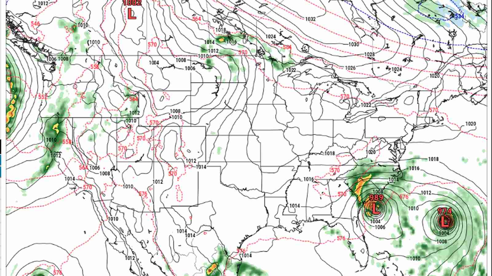
Two weeks after the statistical peak of the Atlantic hurricane season, the tropics are once again stirring with renewed energy. For the first time this season, two named storms are swirling simultaneously in the Atlantic Basin—a clear sign that the region’s meteorological machinery is far from winding down. Tropical Storm Humberto, which formed on Wednesday afternoon, has rapidly become the focal point for forecasters and coastal communities alike.
As of Thursday morning, Humberto was positioned more than 450 miles northeast of the northern Leeward Islands, on the eastern edge of the Caribbean Sea. The National Hurricane Center reports Humberto’s maximum sustained winds have reached 45 mph, with the storm moving northwest at a steady 10 mph. The system’s current trajectory takes it west-northwest, and meteorologists predict that it could escalate into a hurricane by Saturday afternoon. In fact, forecasts suggest Humberto might reach the threshold of a major hurricane—with winds exceeding 111 mph—by early next week.
What’s driving this intensification? Experts point to Atlantic waters that are notably warmer than average for late September. According to Climate Central, sea-surface temperatures are running 2 to 3 degrees above the norm. Warmer oceans act as jet fuel for tropical cyclones, providing the energy required for rapid strengthening. This phenomenon was illustrated vividly earlier this week, when Hurricane Gabrielle morphed from a tropical storm into a Category 4 hurricane in less than 24 hours, a feat that underscores the evolving dynamics of hurricane formation in a warming world.
Hurricane Gabrielle’s Rapid Transformation and Current Trajectory
Gabrielle’s explosive intensification—gaining 65 mph in wind speed within a single day—caught the attention of scientists and the public alike. The National Hurricane Center attributes such rapid changes to unusually warm sea-surface temperatures, a trend increasingly linked to human-driven climate change. As Reuters and Climate Central have documented, Gabrielle is just the latest in a series of storms demonstrating ‘Extreme Rapid Intensification,’ a term meteorologists now use with growing frequency.
Thankfully, Gabrielle has since weakened to a Category 1 hurricane, with winds near 75 mph. Its current path takes it over the Azores Thursday night into early Friday, where residents are bracing for heavy rainfall, dangerous surf, and powerful gusts. After crossing the Azores, Gabrielle is expected to continue toward Portugal, Spain, and Morocco, losing strength as it moves over cooler waters and land. The episode serves as a sobering reminder of how quickly these systems can change course and character, challenging even the most sophisticated forecasting models.
A New Tropical Threat Emerges for the U.S. East Coast
While Humberto spins harmlessly in the open Atlantic, a separate tropical system is gathering strength with its sights set on the United States. According to a forecast bulletin from the National Hurricane Center, an area of low pressure is expected to form along a tropical wave near the southeast Bahamas late Thursday or early Friday. This low is projected to organize into a tropical depression within a couple of days as it approaches the central and northwest Bahamas.
Forecasters are watching this disturbance closely, as the latest model guidance suggests a northwestward track toward the southeastern coast of the continental United States. Landfall is possible early next week, with the area of greatest concern stretching from Georgia to North Carolina. If the system strengthens into a tropical storm, it will be named Imelda, following Humberto in the 2025 Atlantic hurricane naming sequence.
Residents along the East Coast are being urged to monitor official updates, as even a moderate tropical cyclone can bring disruptive rains, coastal flooding, and dangerous surf conditions. The looming threat highlights the unpredictability of the Atlantic hurricane season—a time when weather patterns can shift in hours, not days.
Climate Change and the Future of Atlantic Storms
The recent activity in the Atlantic has reignited conversations about climate change and its impact on hurricane behavior. As experts from Climate Central have noted, warming oceans are not just making hurricanes stronger; they are also accelerating their rate of intensification. The phenomenon of ‘Extreme Rapid Intensification’—where storms gain 35 mph or more in wind speed within 24 hours—is now seen with increasing regularity.
Scientists warn that as global temperatures continue to climb, communities in hurricane-prone regions should prepare for more frequent and severe tropical events. The Atlantic hurricane season, which officially runs from June through November, may see longer periods of heightened activity and storms capable of producing record-breaking winds and rainfall.
These developments have prompted renewed calls for investment in coastal resilience, improved forecasting technology, and proactive emergency planning. As storms like Humberto and Gabrielle demonstrate, preparation and timely information can make all the difference when nature’s power is unleashed.
Staying Informed: The Importance of Reliable Updates
With multiple storms brewing, the National Hurricane Center and other agencies are urging residents and travelers in affected regions to stay informed. Weather bulletins, official advisories, and real-time tracking can be found on government websites and reputable news outlets such as Reuters and Statesman. Social media channels like those of Climate Central are also providing timely updates and scientific context.
The coming days will be critical, as Humberto approaches hurricane strength and the new tropical disturbance nears the East Coast. Experts recommend preparing emergency kits, reviewing evacuation plans, and staying alert to changing forecasts, especially as the situation can evolve rapidly.
Assessment: The surge of activity in the Atlantic underscores how warming oceans are reshaping the risks of hurricane season. Humberto’s intensification and the emergence of a new threat for the U.S. East Coast highlight the urgent need for adaptive strategies, improved forecasting, and community preparedness in the face of evolving climate realities.