
In the frigid waters of the Bering Strait, a unique geographical phenomenon captures the intersection of nature and human-made timekeeping. The Diomede Islands, consisting of Big Diomede (Ratmanov Island) and Little Diomede (Kruzenshtern Island), stand as silent sentinels between the continents of Asia and North America.
A Narrow Divide
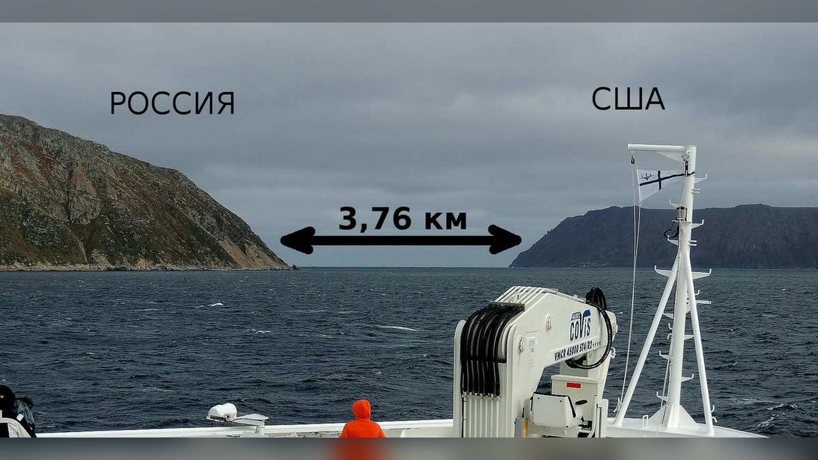
The photograph of this strait captures the stark, icy proximity of these two landmasses. Only 3.8 kilometers (approximately 2.4 miles) of water separate the Russian-administered Ratmanov Island from the American-administered Kruzenshtern Island. While this distance is easily traversed by boat in summer or across the ice in winter, the islands exist in two different days.
The International Date Line
The International Date Line passes directly between the two islands. Because of the specific time zone configurations adopted by Russia and the United States, the clock on Ratmanov Island is 21 hours ahead of the clock on Kruzenshtern Island during standard time. This has earned them the nicknames ‘Tomorrow Island’ and ‘Yesterday Island.’ The image serves as a visual reminder of how arbitrary human boundaries can appear against the backdrop of the Earth’s rotation.