


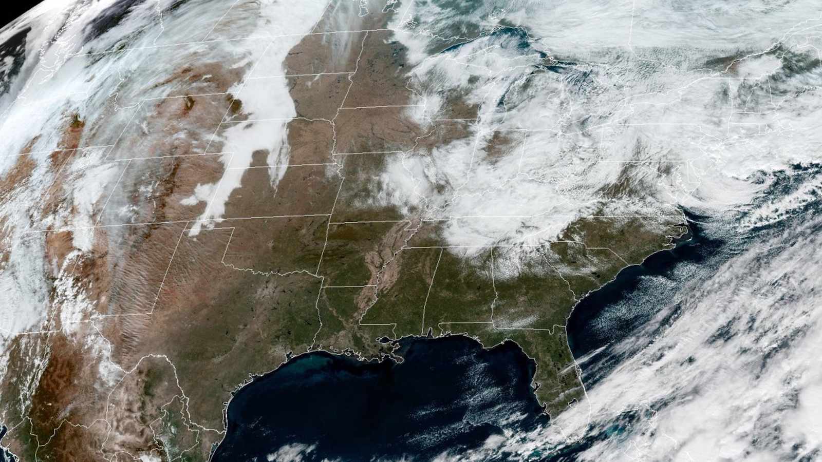
On Friday, November 13, 2026, a departing winter weather system dropped significant snowfall across parts of New York State while setting the stage for a broader meteorological shift nationwide. According to reporting from NBC News, the storm accumulated more than a foot of snow in several communities before gradually tapering off. Hartwick recorded 12.5 inches, Burlington received 12 inches, Exeter Center registered 11.5 inches, and Cherry Valley saw 10 inches of snow. Additionally, regions throughout the Catskills measured between 3 and 7 inches of accumulation.
As the initial system heads out to sea, cold northerly winds moving in behind it are creating lake-effect snow, rain showers, and light snow across higher terrain in the Northeast, including the Adirondacks, Berkshires, and the Green and White Mountains. Meanwhile, wet snow and rain showers impacted portions of the I-95 corridor stretching from Philadelphia to New York, accompanied by minor coastal flooding along the Jersey Shore and up toward Cape May.
The First Widespread Freeze of the Season
Moving past the immediate Northeast impact, a secondary storm system arriving for the weekend of November 13, 2026, is introducing below-freezing temperatures to millions of residents across multiple regions of the United States. Cities are experiencing notable wind chill drops, with Chicago forecast to see wind chill temperatures of 24 and 27 degrees over the weekend, New York tracking between 34 and 40 degrees, Atlanta noting 31 and 32 degrees, and Tallahassee, Florida, registering wind chill values between 35 and 32 degrees.
Consequently, frost and freeze alerts have been issued by meteorologists, stretching from eastern Oklahoma across to the coastal Carolinas and extending as far south as southern Alabama. Major metropolitan and regional population centers under these active alerts include Tulsa, Oklahoma; Little Rock, Arkansas; Birmingham, Alabama; Atlanta, Georgia; and Raleigh, North Carolina. These alerts warn residents and agricultural producers of conditions that could harm sensitive late-season vegetation and impact early morning commutes.
Pacific Systems and Regional Weather Hazards
Concurrently, a separate weather system arriving off the Pacific Ocean on Friday is delivering heavy rainfall from northern Washington down to southern California, accompanied by heavy mountain snowfall across the Sierra Nevada range. Southern California faces the possibility of isolated thunderstorms, including within the Los Angeles metropolitan area. Through Saturday, total rainfall amounts are projected to reach up to 3 inches from northern California through southwestern Oregon. In the Sierra Nevada, elevations above 6,000 feet are expecting snowfall totals between 12 and 18 inches, with subsequent storm systems scheduled to reach the Pacific Northwest late Saturday through Sunday.
Further south, weather hazards shift toward heavy precipitation in the Gulf Coast region. On Sunday, Southeast Texas and western Louisiana face heavy rainfall capable of producing localized urban flooding. Rainfall totals are generally expected to range between 1 and 2 inches, though localized accumulations along the upper Texas coast could reach 3 to 5 inches. Major population centers including Houston, Galveston, Beaumont, and Lake Charles remain within the affected zone. Furthermore, the region could experience severe storms producing damaging winds stretching from Beaumont to Brownsville.