


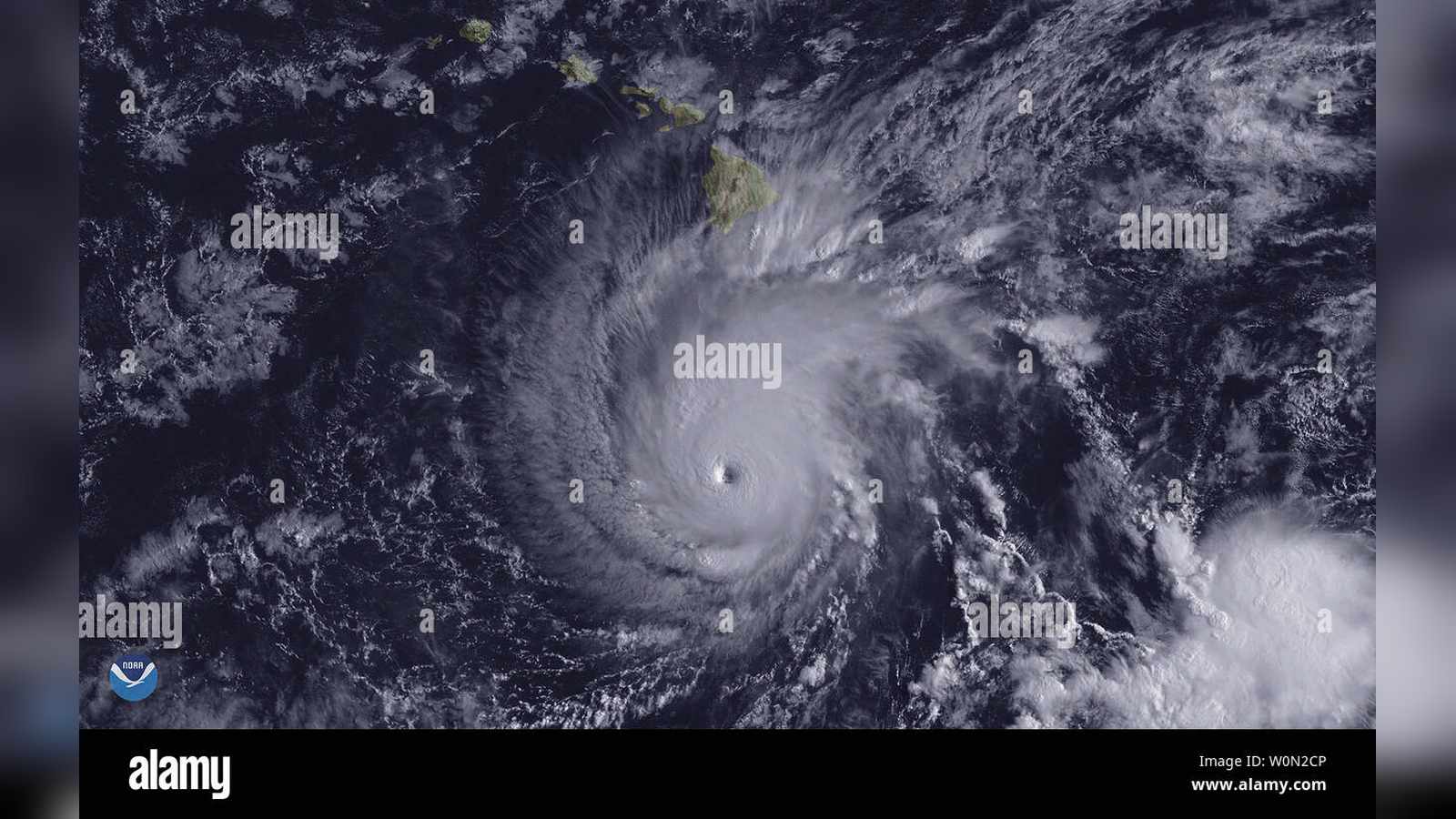
Rapid Intensification to Category 5
Hurricane Lowell has regained Category 5 status in the Central Pacific, packing maximum sustained winds of 160 mph as of Saturday, September 5, 2026. The Central Pacific Hurricane Center (CPHC) in Honolulu reports that the storm is located approximately 600 miles south-southwest of Honolulu and 615 miles south-southwest of Lihue, drifting westward at 7 mph.
Data from Air Force Hurricane Hunter aircraft confirmed the rapid intensification, revealing a clear eye surrounded by a balanced ring of intense thunderstorms. Hurricane-force winds currently extend up to 60 miles from the center, while tropical-storm-force winds reach outward up to 160 miles.
This report draws on information published by staradvertiser.com and newsweek.com.
Forecast Path and Kauai Impact
While Lowell is currently moving west, meteorologists expect a significant shift in its trajectory. A weakening ridge of high pressure to the north of Hawaii is forecast to trigger a sharp northward turn on Sunday. This trajectory change will likely bring the major hurricane dangerously close to Kauai County late Monday and Monday night.
Forecasters at the CPHC warn that while some gradual weakening is expected as the storm encounters cooler waters and southwesterly wind shear, Lowell will likely maintain major hurricane strength as it approaches the islands. Residents in Kauai County are being advised to prepare for potential impacts, with official hurricane watches expected to be issued throughout Saturday.
Anticipated Rainfall and Hazardous Conditions
Regardless of the exact proximity of the storm’s core to land, deep tropical moisture is expected to spread across the island chain starting Sunday afternoon. The National Weather Service (NWS) projects significant rainfall totals, with Kauai and the Big Island expected to receive 3 to 6 inches of rain, and localized totals potentially exceeding 10 inches. Maui is forecast to see 2 to 4 inches, while Oahu and other islands may receive 1 to 2 inches.
Ocean conditions remain hazardous due to swells generated by both Lowell and the remnants of Hurricane Karina, which is currently tracking east of Hilo. High surf advisories are in effect for south and east shores across all islands, with wave heights expected to reach 12 to 14 feet along southern and eastern exposures. A small craft advisory remains active across all Hawaiian waters, with east winds up to 25 knots and seas reaching 12 feet.
Broader Pacific Context
The Central Pacific remains active as meteorologists monitor multiple systems. While Hurricane Marie continues to move northwest away from land off the coast of Baja California, the remnants of Hurricane Karina are expected to be absorbed by Lowell’s circulation early next week. Local authorities, including city and state staff, have begun coordination efforts to support vulnerable populations, including deliveries to senior housing, as residents across Kauai stock up on emergency supplies.