


Emergency Escalation in Benton County
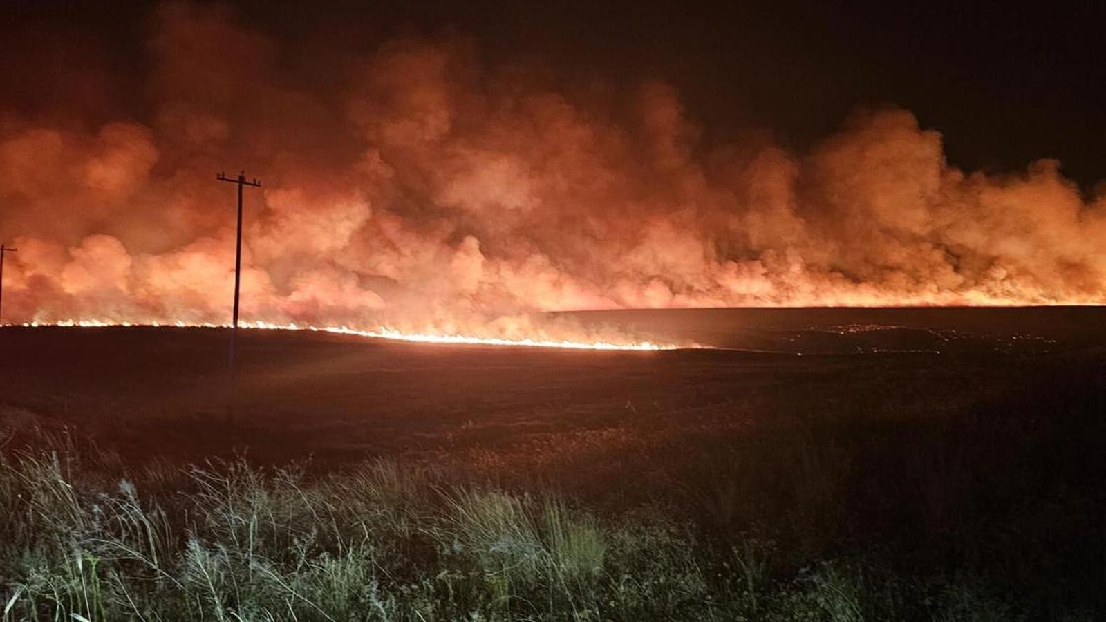
On Friday, July 24, 2026, a series of fast-moving brush fires erupted in Kennewick, Washington, forcing emergency management agencies to issue Level 3 “GO NOW” evacuation orders. The sudden outbreak of multiple blazes—most notably the Locust Grove Fire and the Finley Fire—stretched local firefighting resources and triggered a coordinated multi-agency response. Benton County Fire District #1 (BCFD1) and local police departments immediately prioritized saving lives and protecting threatened structures. The rapid spread of the fires has highlighted the extreme vulnerability of the region during peak summer conditions, where dry fuels and volatile weather create a volatile mix for emergency responders.
The Multi-Front Fire Threat: Locust Grove, Finley, and Bateman Road
The fire emergency developed rapidly on several distinct fronts, complicating containment efforts. The Locust Grove Fire, which broke out near East Locust Grove Road and East SR 397, quickly expanded to approximately 20 acres with 0% containment. It advanced toward residential areas south of West 45th Avenue, prompting police and fire crews to focus heavily on the South Olympia Street corridor. Because of the fire’s rapid trajectory, emergency officials issued Level 3 evacuations for Inspiration Heights and all areas from West 50th Avenue and south. Law enforcement officers went door-to-door, urging residents to leave immediately and contact neighbors to ensure no one was left behind.
Simultaneously, firefighters were dispatched to the Finley Fire, located in the 205800 Block of East Finley Road. Although initially measuring less than an acre (approximately 0.11 acres according to tracking service WatchDuty), the Finley Fire posed an immediate threat to nearby homes. BCFD1 confirmed that the fire had crossed Finley Road, forcing the complete closure of the thoroughfare between Pullman Road and Lexington Road. At least two homes were directly threatened, and at least one structure was involved in the flames. To make matters more complex, a third vegetation fire was reported in the area of Bateman Road and Owens Road, forcing BCFD1 to divide its personnel and equipment across three active fire zones in the south Kennewick and Tri-Cities area. Strike teams were requested to establish structural protection lines around vulnerable residential properties.
Critical Weather and the Red Flag Warning
The rapid spread and extreme behavior of these fires were heavily driven by severe meteorological conditions. The National Weather Service maintained a Red Flag Warning for the region, covering Kittitas Valley, the Lower Columbia Basin of both Oregon and Washington, the Central Blue Mountains, and the Northern Deschutes National Forest. Forecasters warned of an upper-level low pressure system ejecting into the region, which brought dry, windy conditions through the Cascade Gaps and central Oregon. Winds of 15 to 25 mph, with gusts reaching up to 35 mph, combined with relative humidity levels dropping to a critical 20 percent, created an environment where any ignition would catch and spread with extreme velocity.
In addition to the fire danger, the Washington State Department of Ecology and the Benton Clean Air Agency issued a joint Air Quality Alert. Wildfire smoke from regional blazes, trapped by local atmospheric conditions, caused air quality to deteriorate to unhealthy levels. Health officials warned residents that pollutants in smoke can cause burning eyes, runny nose, and aggravate serious heart and lung diseases. Families were strongly advised to limit outdoor activities and keep children indoors, while individuals with respiratory conditions were urged to follow strict medical advice.
Evacuation Logistics and Public Safety Infrastructure
As emergency personnel worked to contain the flames, local authorities established critical support networks for displaced residents. The American Red Cross and local authorities set up a temporary evacuation center at the Southridge Sports Complex, located at 2901 Southridge Blvd. To accommodate the growing number of evacuees from the Locust Grove Fire, an additional emergency shelter was established in the parking lot of South Hills Church at 3700 West 27th Avenue. Law enforcement officers went door-to-door in the high-risk zones, urging residents to comply with the Level 3 “GO NOW” orders and contact neighbors to ensure everyone escaped safely. The level-based evacuation system was strictly enforced: the Level 3 “Go Now” zone applied to Inspiration Heights and West 50th and south, while a Level 2 “Be Ready” warning was maintained for adjacent neighborhoods, signaling that residents must be prepared to leave at a moment’s notice.
Regional Vulnerability and the Path to Containment
The fires in Kennewick highlight the broader vulnerabilities of the Tri-Cities region, where dry shrub-steppe vegetation, low annual precipitation, and high summer winds create a perennial wildfire threat. The combination of rural residential developments encroaching on wildlands—often referred to as the wildland-urban interface—significantly increases the complexity of fire suppression efforts. Moving forward, containment remains the primary objective for BCFD1 and cooperating state agencies. While strike teams have successfully prevented widespread loss of life, the combination of zero percent containment on the Locust Grove Fire and the persistent Red Flag Warning means that the threat remains active. Investigators have not yet determined the official cause of either the Finley or Locust Grove fires, and damage assessment teams will only be able to fully survey the affected structures once the active fronts are stabilized.