


Developing Super El Niño Trends
Meteorological data from late August 2026 indicate that a ‘Super’ El Niño event is on a trajectory to dominate the 2026-27 winter season. Seasonal forecast models, including those from the European Centre for Medium-Range Weather Forecasts (ECMWF) and the National Centers for Environmental Prediction (NCEP), show ocean heat anomalies in the tropical Pacific exceeding the threshold for an extreme event.
The core of this development is a significant subsurface temperature anomaly, described by experts as a downwelling Kelvin Wave, with peak temperatures more than 9°C (16°F) above normal in the top 250 meters of the tropical Pacific. This energy reservoir serves as the engine for the event, ensuring sustained atmospheric forcing well into the winter months.
Global Jet Stream Impacts
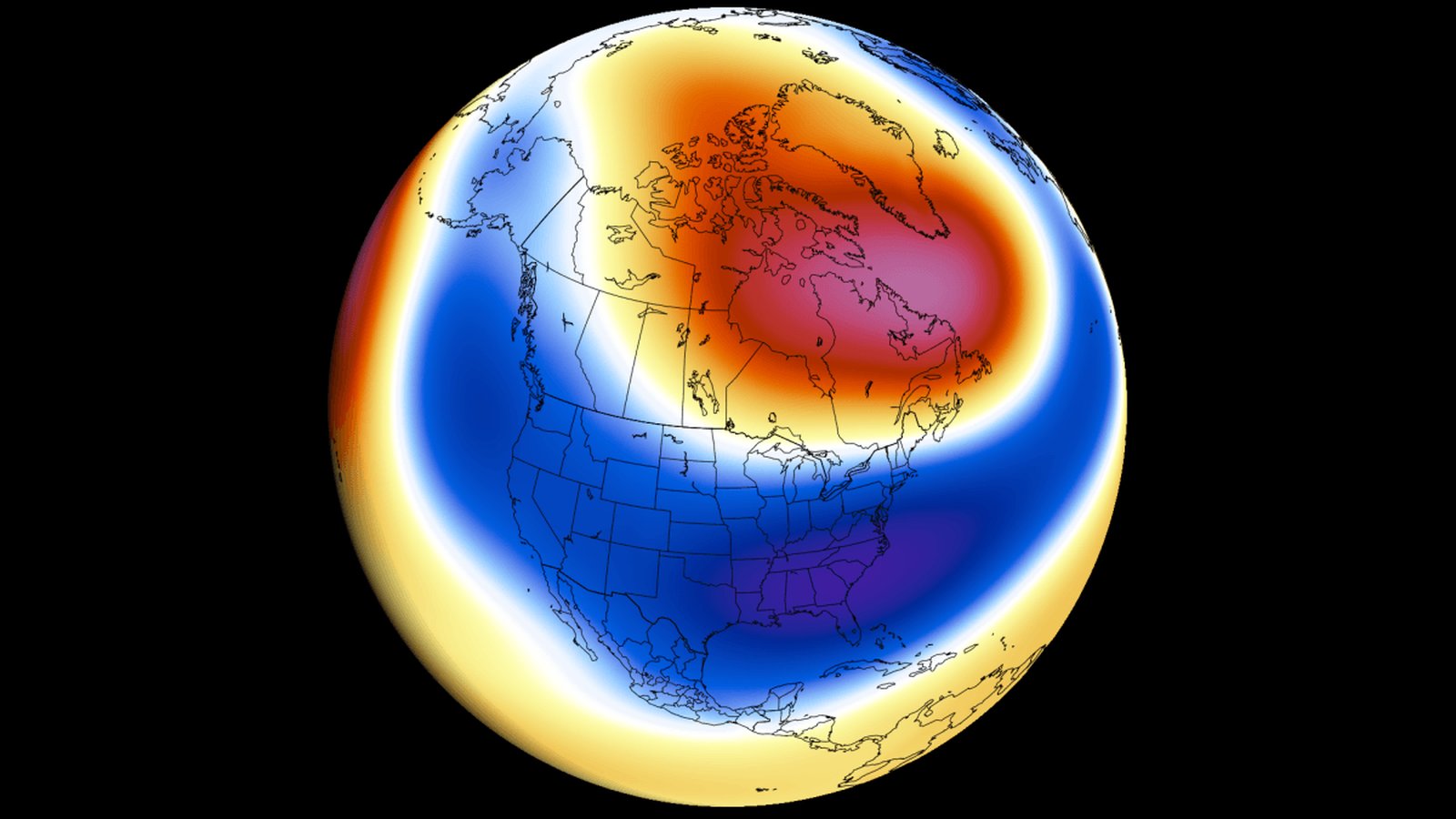
The primary consequence of a Super El Niño is the restructuring of global atmospheric circulation, specifically the formation of a split-flow jet stream pattern. As the tropical Pacific releases energy, it creates a planetary wave train that alters pressure systems across the Northern Hemisphere. Current projections for the December–February period show a deep, intense low-pressure zone over the North Pacific, which forces a massive high-pressure ridge over Canada and the northern United States.
This configuration is expected to drive a sharp temperature divide. The northern regions are likely to experience milder, above-average temperatures due to the high-pressure ridge, while an active subtropical jet stream channels moisture and cooler conditions across the southern United States. For Europe, the pattern favors a dominant westerly flow, which typically results in milder temperatures across much of the continent.
Regional Precipitation and Snowfall
The anticipated split-flow jet stream will likely dictate regional snowfall patterns. Historical data from past Super El Niño events suggest that persistent southern storm activity will drive above-normal snowfall in the Sierra Nevada, the Four Corners region, and the Southern Rockies. Conversely, the Pacific Northwest, the Great Lakes, and parts of the Northeast may face snowfall deficits as the Canadian ridge suppresses northern storm tracks.
For Europe, the projections indicate that widespread snowfall deficits are possible across the northwest and north-central regions due to the mild Atlantic westerly flow. Increased snowfall is currently modeled only for northern and northeastern areas where temperatures are expected to remain sufficiently low to support frozen precipitation.
Next Steps in Forecasting
As the winter season approaches, meteorologists will continue to monitor the interaction between the El Niño anomaly and the Polar Vortex. While current models suggest a strong, amplified winter pattern, individual wind bursts and atmospheric variability remain factors that will require monthly adjustments to seasonal outlooks. Official guidance from meteorological agencies will be essential for regional climate preparedness as the peak of the event approaches in November and December 2026.