


A Rapid Escalation to ‘Super’ Status
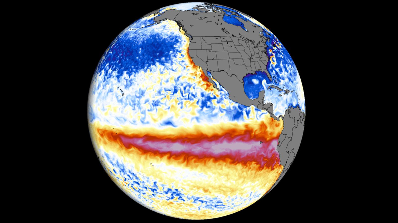
The natural climate cycle known as El Niño has officially transitioned into a “super” event, according to data from the National Oceanic and Atmospheric Administration (NOAA). As of September 14, 2026, the Niño 3.4 Relative Oceanic Niño Index (RONI) hit 2.0 degrees Celsius above average, crossing the critical threshold that forecasters use to define a “very strong” or “super” El Niño.
This rapid strengthening is unprecedented for this time of year. While El Niño was first declared in June 2026, its pace of development has outstripped historical comparisons. NOAA forecasters indicate that there is a 75% probability that this event will peak as the strongest on record since systematic observations began in 1950. Unlike previous events, this El Niño is unfolding against a backdrop of significantly higher global sea surface temperatures, a consequence that CNN reports is being exacerbated by climate change.
The Mechanics of a Changing Climate
El Niño is defined by warmer-than-average water temperatures along the equator in the Pacific Ocean, which subsequently shift atmospheric circulation. The current event is being tracked using a refined RONI metric, which accounts for the warming baseline of the Pacific caused by fossil fuel pollution. Erin Coughlan de Perez, an associate professor of climate science at Tufts University, noted that the speed of this intensification suggests the event is poised to set historical records.
The atmospheric consequences are already visible. In the Atlantic, extreme wind shear has effectively suppressed hurricane formation, creating a record-long wait for the season’s first major storm. Conversely, the Pacific has seen explosive activity, with 16 storms forming this year, including two Category 5 hurricanes. Hawaii has been uniquely impacted, facing three separate tropical systems in less than a month.
Global Stakes and Winter Forecasts
As the phenomenon approaches its peak strength in the coming winter months, its influence on global weather is expected to intensify. According to Time for Kids, the impacts are varied and severe:
- United States: Northern states may experience warmer-than-usual winters, while southern regions face higher risks of heavy rain, snow, and severe weather events, including tornadoes.
- International Impact: Indonesia is currently battling widespread wildfires fueled by tinder-dry vegetation, a direct result of drought conditions linked to the climate pattern. Similar drought risks are projected for Southern Africa and northern parts of South America.
The combination of El Niño and long-term climate warming has contributed to a record-hot summer globally. Meteorologists warn that this trajectory could make 2026 and 2027 among the hottest years on record for the planet.
Infrastructure and Public Resilience
The shift to a “super” status has significant implications for local governments and emergency services. In California and other coastal areas, the threat of severe winter storms has already prompted emergency discussions regarding infrastructure integrity. Local authorities are being urged to accelerate preparations, including the establishment of warming centers and the activation of emergency alert systems, as the window to mitigate potential damage from extreme weather narrows.