


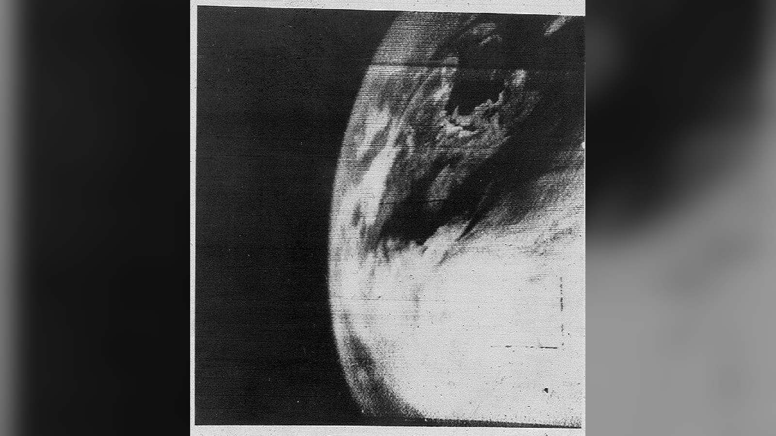
A grainy, fragmented arrangement of smudged light and dark tones fills the frame, capturing a distorted swath of cloud patterns hovering above the northeastern coast of North America and the adjacent Atlantic Ocean. Taken on April 1, 1960, this historic frame is not a single pristine photograph as we understand digital imaging today, but a crude, electronically transmitted composite built from primitive television camera tubes. It represents a monumental threshold in human history: the very first time our home planet was photographed from the vantage point of outer space. Looking closely at the frame, one sees jagged coastlines obscured by swirling meteorological formations—vague smudges that signaled the dawn of a completely new way of perceiving humanity’s place in the universe.
The Moment Behind the Image
The shutter moment occurred during the infancy of the Space Age, just over two years after the launch of Sputnik 1 had rattled the geopolitical landscape. Launched on April 1, 1960, from Cape Canaveral aboard a Thor-Able rocket, the Television Infrared Observation Satellite, known simply as TIROS-1, carried two experimental television cameras designed to gaze downward at Earth’s weather systems. As the drum-shaped satellite orbited at an altitude of roughly 450 to 470 miles, its cameras scanned the sunlit portions of the globe. The resulting electronic signals were beamed down to ground receiving stations in Wallops Island, Virginia, and Kaena Point, Hawaii, where they were painstakingly reconstructed onto photographic film. This specific image captured the imagination of scientists and the public alike, proving that humanity could finally monitor atmospheric conditions from above on a global scale.
Photographer and Provenance
Strictly speaking, the image had no human photographer behind a traditional viewfinder; instead, it was recorded by a 1/2-inch vidicon television camera mounted on a robotic spacecraft engineered by RCA for the National Aeronautics and Space Administration (NASA) and the U.S. Army Signal Research and Development Laboratory. The operational program fell under the guidance of the newly formed space agency and military researchers working to harness space technology for operational forecasting. The surviving prints and electronic archives of TIROS-1 were preserved by federal agencies, NASA historians, and institutional repositories such as the Smithsonian National Air and Space Museum. Because the technology relied on analog magnetic tape and early scanning lines, the surviving archival iterations retain a distinct, artifact-laden texture that underscores the experimental nature of the mission.
Historical Context
Before April 1960, human understanding of weather was strictly terrestrial, pieced together from surface barometers, radiosonde weather balloons, and isolated reports from ships at sea. Vast oceans and remote polar regions remained blind spots where storms could brew undetected. TIROS-1 shattered these geographical limits. Although the satellite operated for only 78 days before suffering an electrical failure, it transmitted nearly 23,000 usable images back to Earth. It laid the immediate groundwork for continuous meteorological observation, quickly evolving into civilian weather satellite constellations that today track hurricanes, monitor climate shifts, and deliver routine daily forecasts across the globe.
Why It Still Matters
This rudimentary photograph endures as an iconic cultural and scientific artifact because it marks the literal beginning of our planetary self-awareness. Long before the iconic ‘Blue Marble’ photograph taken by the crew of Apollo 17 in 1972 provided a crisp, full-disk color portrait of Earth, TIROS-1 provided the primitive first steps of environmental surveillance from orbit. It bridged the gap between speculative science fiction and the reality of an interconnected, observable globe, permanently altering how humanity visualizes its fragile home.