


Industrial Roots of the Cornish Landscape
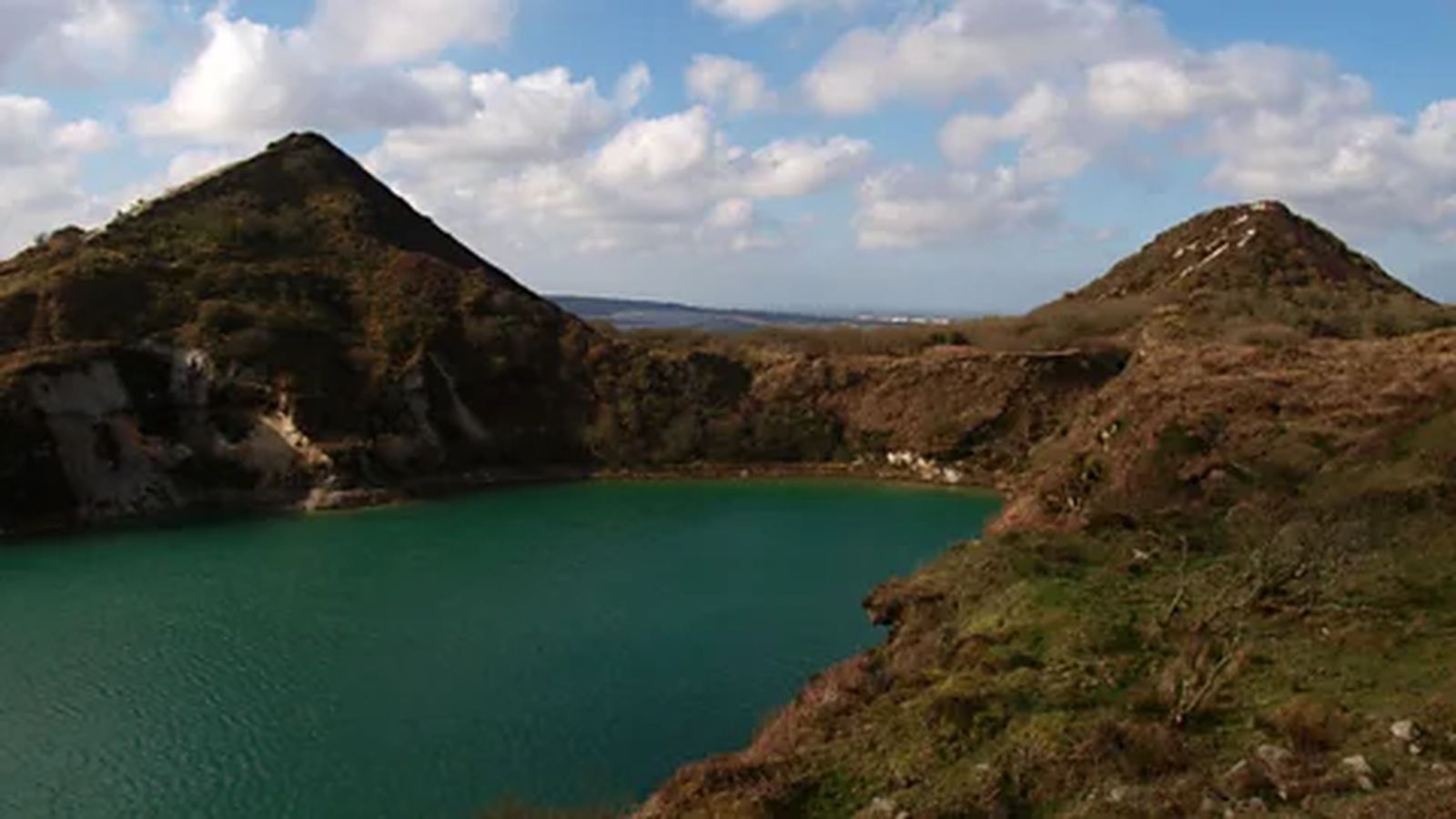
Centuries of china clay mining have transformed a 35-square-mile (91-square-km) expanse in Cornwall into a surreal terrain of towering white peaks and vivid green lagoons, a region affectionately known by locals as the “Cornish Alps” BBC reported in an article published on November 8, 2026. Beginning in 1746 when Plymouth chemist William Cookworthy identified kaolin deposits near Helston, the industry expanded rapidly during the 19th and 20th centuries. Prized as “white gold” for its use in porcelain, paper, toothpaste, and cosmetics, Cornwall produced roughly half of the world’s china clay by 1910.
Steve Hawken, a former clay worker who spent 15 years starting his 37-year career as a kettle boy at Littlejohns Pit, recalled hearing sirens and blasting from his classroom during the mid-20th-century heyday. Today, Hawken works as a volunteer guide at Wheal Martyn, the UK’s only china clay museum, which is housed in two former Victorian-era clay works near St Austell and serves as a key information hub for visitors exploring the surrounding area.
Expanding Access Through New Multi-Use Trails
As old mining pits close and vegetation reclaims the industrial footprint, public access to the landscape is expanding. In 2025, Imerys, the French corporation owning the land, opened 21 miles (34km) of new permissive footpaths, bringing the total network to 38 miles (62km). These trails accommodate walkers, cyclists, and horse riders, connecting rural sites to larger routes like the Clay Trails that link to Par Beach and the Luxulyan Valley along the National Cycle Network.
Visitors following these trails encounter striking geographic features, including flooded pits such as the 50-yard-deep Lansalson Pit, whose milky turquoise water resembles glacial lakes in the Canadian Rockies. Local authorities and guides emphasize that swimming in these pits is strictly forbidden due to deep underlying sediment and safety hazards. Walkers are also advised to remain strictly on marked paths as they navigate near active kaolin processing sites.
Preservation of Local Landmarks and Ongoing Operations
The transformation also highlights community efforts to preserve industrial heritage. The Great Treverbyn Tip, known locally as “Sky Tip,” has stood as a landmark since the 1930s. When Imerys proposed flattening the pyramid-shaped waste peak in 2014, local residents successfully rallied to protect it. Today, the summit flies the Cornish flag as a symbol of regional identity.
Although mining operations have contracted over the decades, china clay extraction continues to support local employment and generates an estimated £40 million ($53.9 million) annually for the regional economy. Reserves remain sufficient to sustain mining for decades, creating a unique coexistence between active industrial extraction, wildlife recovery, and recreational tourism across Clay Country.