


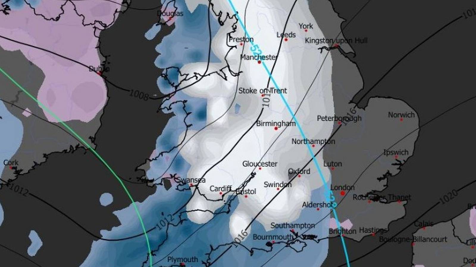
As the final days of 2025 draw to a close, the UK braces for a dramatic turn in the weather. The Met Office, Britain’s national weather service, has issued yellow warnings for snow and ice across northern Scotland, with the chill set to spread more widely as 2026 begins. For millions, the forecast is more than just a headline—it’s a signal to change plans, check road conditions, and prepare for possible disruption.
On New Year’s Day, from 6am through midnight on January 2, northern Scotland—including Central, Tayside and Fife, Grampian, Highlands and Eilean Siar, Orkney and Shetland, and Strathclyde—faces heavy, frequent snow showers. According to the Met Office, 2–5cm of snow is expected in many areas, with up to 10cm locally by Friday morning. Above 200m, that number climbs: 10–20cm is possible, and on the highest hills and routes, drifts of 30cm or more could accumulate. The rest of the UK isn’t out of the woods—wintry showers and icy conditions are forecast to spread further south as the week progresses (NationalWorld, The Independent).
But why do snow forecasts seem to change so often? The answer lies in the science. Predicting snow isn’t as simple as tracking rain. The Met Office uses satellites, radar, weather stations, and sophisticated computer models to simulate atmospheric behavior. Temperature margins play a critical role: a difference of just one or two degrees can mean the difference between snow, sleet, or cold rain. Urban environments complicate matters further; cities tend to be warmer than surrounding areas, so snow that settles in rural Scotland might melt on Glasgow’s streets.
As new data comes in—sometimes several times a day—the Met Office updates its forecasts. To the public, these changes may look inconsistent, but they actually reflect increasing accuracy as weather systems approach. The language is often cautious: phrases like “a chance of snow” or “possible snow on higher ground” speak to the uncertainty inherent in predicting such variable conditions.
Alongside the forecasts, colour-coded weather warnings are issued to communicate risk. Yellow means possible disruption, such as icy roads or delayed travel. Amber signals a higher likelihood of significant problems, from power cuts to widespread transport chaos. Red, the rarest, warns of dangerous conditions with real risk to life. These warnings are impact-based—they consider not just the weather itself, but how it will affect people, infrastructure, and services. For example, five centimetres of snow in rural Scotland might be routine, but the same amount in southern England can bring trains and buses to a halt (NationalWorld).
This week, the cold won’t just be felt outdoors. The UK Health Security Agency (UKHSA) has issued yellow and amber cold health alerts across England, with the north east and north west on higher alert until January 5. Cold snaps like these can pose serious risks, especially to those over 65 or living with health conditions. The risk of heart attacks, strokes, and chest infections rises as temperatures plummet. Caroline Abrahams, charity director at Age UK, reminds everyone: «These conditions are potentially hazardous for older people, especially if they are living with serious health conditions like cancer, are already unwell for some other reason or are generally frail.»
Local councils rely on Met Office data to decide when to grit roads and pavements, and schools and workplaces may announce closures or remote working based on updated forecasts. For farmers, snow predictions can be crucial for protecting livestock and crops, while emergency services and energy providers prepare for increased demand and callouts.
In recent years, the science of snow forecasting has improved, but the unpredictability remains. Social media often amplifies dramatic snow maps and worst-case scenarios, spreading images that may exaggerate the risk. The Met Office counters this with careful, measured updates, urging the public to rely on official channels—especially in the 48 hours leading up to a potential snow event.
Climate change is reshaping the landscape of British winters. While average temperatures are rising, cold spells and snow events haven’t vanished; instead, they’re more variable and harder to predict. The Met Office continues to refine its models to reflect these changes, striving to provide accurate information in a world where a winter’s day can turn on a dime.
So, what does all this mean for daily life? It’s about readiness. Whether it’s a parent weighing the odds of a school closure, a commuter planning a route, or a council deciding when to salt the roads, the Met Office snow forecast is a vital tool. It’s not just about flakes falling from the sky—it’s about resilience, adaptation, and respecting the power of winter weather. In a country where snow can mean anything from a quiet morning to nationwide disruption, preparedness is everything.
The facts are clear: the UK faces a period of cold, snow, and ice as 2025 turns to 2026. The Met Office’s cautious, data-driven approach stands in stark contrast to the noise on social media, offering the best chance for the public to make informed decisions. In a changing climate, understanding both the science and its limitations is key. For now, the watchwords are vigilance and preparation.