


Emergency Declaration and Regional Impact
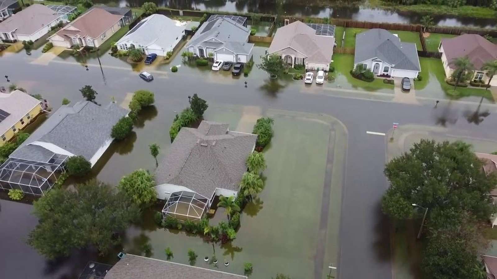
Florida Governor Ron DeSantis issued a state of emergency on Monday, November 2, 2026, covering seven counties to expedite disaster resources and state assistance. The emergency declaration follows back-to-back historic rainfall events that delivered up to 20 inches of rain in just 12 hours south of Palm Bay, according to radar estimates cited by FOX Weather. National Oceanic and Atmospheric Administration (NOAA) criteria categorize rainfall exceeding 15.5 inches over a 12-hour period as a 1,000-year flood event.
The severe weather has severely disrupted transportation and local infrastructure. The National Weather Service issued a Flash Flood Emergency for Brevard County after receiving multiple reports of vehicles stalled in rising floodwaters around the Palm Bay area. Although that specific emergency designation expired, a broader Flash Flood Warning remained in effect as continuous downpours saturated the region’s soils.
Rainfall Totals and Meteorological Context
The storm system delivered unprecedented precipitation totals across parts of the Sunshine State without the presence of a tropical storm. According to WUFT, Palm Beach Gardens registered 17 inches of rain in just six hours on Sunday, November 1, 2026, exceeding 1,000-year recurrence thresholds by nearly double. Further north, near Melbourne and Palm Bay, cumulative totals surpassed two feet over a 24-hour window.
Widespread precipitation affected major population centers along Florida’s east coast, placing areas from Miami to Jacksonville under a Level 2 out of 4 flash flood risk. Official reporting stations recorded significant Sunday accumulations, including 4.28 inches in West Palm Beach, 1.95 inches in Fort Lauderdale, 1.57 inches in Miami, and 1.47 inches in Tampa.
Institutional Response and Precautions
Local authorities and educational institutions adjusted operations in response to the persistent flood threat. Burrell College in Melbourne announced the immediate closure of its campus for Monday, while municipal emergency management teams monitored rising water levels and dangerous rip currents along Atlantic beaches. Onshore winds generated coastal waves reaching four to six feet, compounding drainage challenges in low-lying coastal zones.
Forecasters anticipate that the most intense rainfall will gradually taper off, though residual moisture will maintain a Level 1 out of 4 flash flood risk on Tuesday, November 3, 2026, from the Space Coast down to Miami as millions of voters head to the polls.