


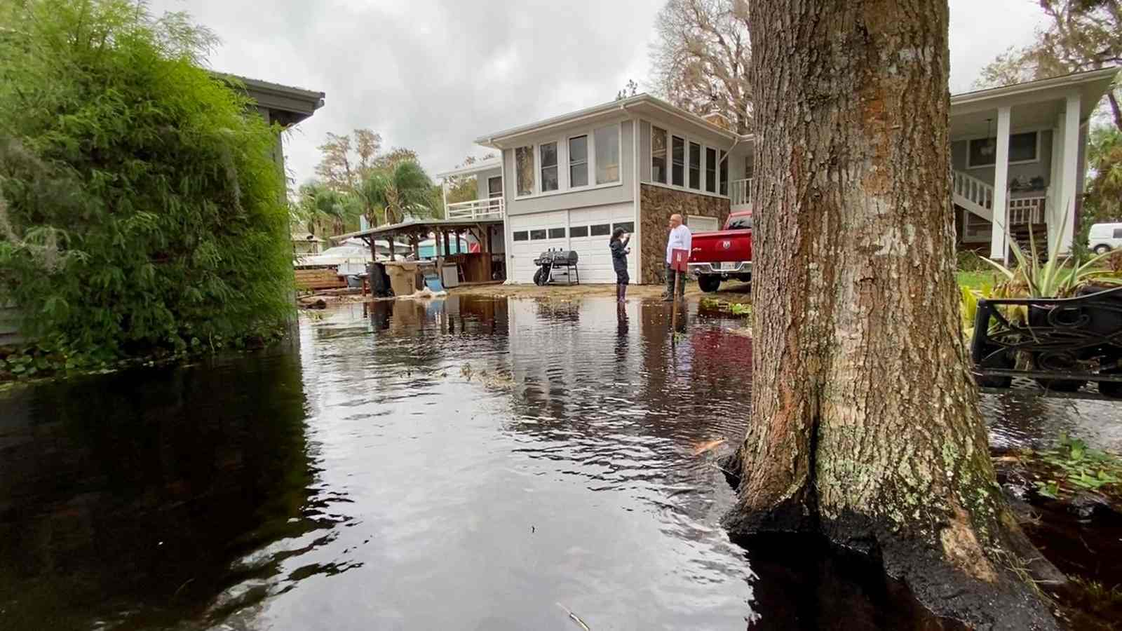
Compounding Flood Crisis and Record-Breaking River Levels
As of November 19, 2026, Central and Northeast Florida are mired in a severe, multi-day flash flood emergency. A persistent, slow-moving storm system is delivering unrelenting torrential rainfall across a region already hampered by critically saturated ground. The National Weather Service (NWS) offices in Melbourne and Jacksonville have maintained extensive Flood Watches, warning that repeated bands of intense precipitation are overwhelming municipal drainage infrastructure and pushing local rivers toward unprecedented thresholds. The crisis is defined by a compounding disaster scenario: historical river levels, exhausted drainage systems, and the potential for the system to reorganize into a named tropical storm are converging to create a prolonged humanitarian and logistical challenge.
The situation along the St. Johns River has reached a critical, historic peak. According to reports from the News 6 Weather Team, the river near Cocoa climbed to 17.6 feet overnight, surpassing the previous record of 17.55 feet set in October 1953. This inundation is not merely a temporary high-water event but a sustained bottleneck that prevents inland drainage from reaching the coast. With the river already at capacity, floodwaters from communities in Brevard and Volusia counties have nowhere to recede, leading to neighborhoods being cut off, vehicles being abandoned, and water entering residential homes. Palm Bay, in particular, remains in a fragile recovery state following an early-November deluge that dumped over 20 inches of rain.
Regional Rainfall Projections and Atmospheric Dynamics
The Weather Prediction Center has designated large portions of Florida’s east-central coast under a Moderate Risk (Level 3 out of 4) for excessive rainfall through Friday. Meteorologists emphasize that the rainfall is not uniform; instead, repeated bands of moisture are training over the same saturated areas. Widespread accumulations of 4 to 6 inches are expected across the region, while localized totals are anticipated to reach 8 to 12 inches. In the most vulnerable coastal segments of Brevard and Volusia counties, some forecast models and station reports indicate isolated totals could exceed 15 inches by the time the system exits the region.
In Northeast Florida, the threat is concentrated along the Interstate 95 corridor, impacting Duval, St. Johns, Flagler, Clay, and Putnam counties. The risk here is significantly exacerbated by tidal cycles. During high tide, elevated coastal water levels prevent effective drainage, causing internal runoff to back up into low-lying urban neighborhoods and agricultural land. The interaction between deep tropical moisture, persistent onshore winds of 25 to 35 mph, and the stalled low-pressure system ensures that even moderate rainfall triggers immediate flash flooding in areas that would typically manage storm runoff with ease.
Infrastructure Strain and Emergency Management
Local authorities, including the WESH 2 First Warning Weather team and various municipal emergency managers, are urging residents to exercise extreme caution and avoid driving through flooded roadways. The exhaustion of drainage infrastructure means that the ground’s ability to absorb water is effectively zero, making rapid, dangerous accumulation inevitable during even brief downpours. The compounding nature of this disaster is evident in the reports from cities like Plantation, Hollywood, and Fort Lauderdale, where rainfall totals have reached 16.4, 13.8, and 12.2 inches, respectively, over the past two days alone.
Civil engineers are struggling with the slow recession of the St. Johns River. Because the river is the primary drainage artery for much of Central Florida, its record-breaking status means the regional drainage system is effectively paralyzed. Emergency managers are currently monitoring county-by-county alerts, with sandbag distribution and evacuation protocols being updated in real-time as water levels rise in areas near Lake Poinsett, Rockledge, and Cocoa.
Potential Tropical Development and Future Uncertainty
The outlook for the coming weekend introduces a new layer of uncertainty. The National Hurricane Center is tracking the same area of low pressure currently drenching Florida, noting a 60% chance of the system developing into a tropical or subtropical storm as it moves toward the Bahamas. If the system organizes, it would be named Kyle. While meteorologists suggest that drier conditions may begin to return to parts of Central Florida by Sunday, the system’s track remains highly variable.
A track closer to the Florida coastline could sustain rainfall and high winds into the weekend, while a trajectory further offshore might allow drier air to finally penetrate the region. Regardless of whether the system receives a formal name, it is expected to carry nor’easter characteristics, bringing strong winds, dangerous rip currents, and significant beach erosion to the Atlantic coast. Residents are encouraged to remain vigilant, as the hydrological impacts of this event—specifically the river flooding—will persist long after the rain stops falling. The recovery phase for many communities will be measured in weeks rather than days, as the combination of record-breaking river levels and saturated infrastructure creates a long-term vulnerability that will require extensive assessment by local and state agencies once the immediate threat of rainfall concludes.