


Executive Directive and Tech Compliance
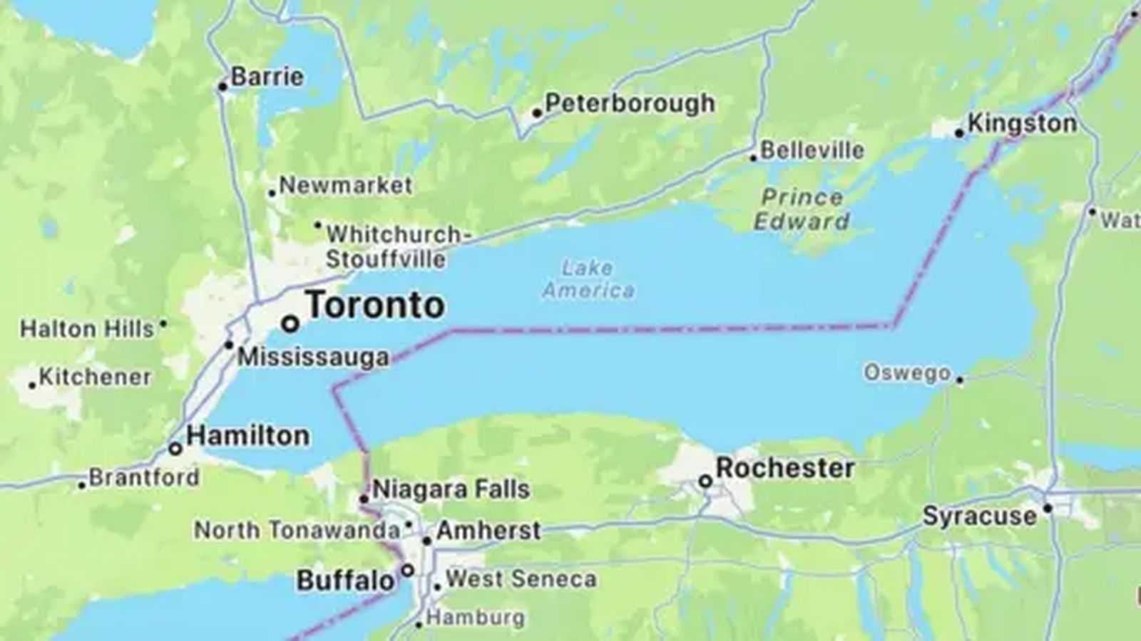
Apple has updated its Maps application for United States-based users, altering the designation of Lake Ontario to “Lake America” in accordance with an executive order signed by US President Donald Trump. The change, reported by the BBC and The Independent, applies exclusively to users within the United States, while mapping users accessing the service from inside Canada will continue to see the traditional name, Lake Ontario. The tech giant’s decision follows direct pressure from the White House, with US Interior Secretary Doug Burgum confirming that Apple was specifically urged to adjust its cartographic data to align with official federal policy.
The renaming directive marks the latest escalation in a bitter trade dispute between Washington and Ottawa. Negotiations over bilateral commerce collapsed late last month after the administration of Canadian Prime Minister Mark Carney broke off talks, citing unacceptable demands from the American side. In response, Washington imposed 50% tariffs on $20 billion (C$28 billion) worth of Canadian exports, prompting Ottawa to announce immediate “dollar-for-dollar” retaliatory tariffs. According to reports cited by Al Jazeera, President Trump reached out directly to executive leadership at major tech firms to ensure corporate mapping services reflected the US government’s geopolitical stance.
This report draws on information published by BBC and The Independent.
Geo-Fencing Toponymy: Tech Platforms as Geopolitical Arenas
Apple is not the first major digital platform to implement the unilateral name change. Alphabet’s Google Maps integrated the “Lake America” designation for US users last week, citing its long-standing corporate policy of aligning geographic labels with official national databases. President Trump’s executive order gives the US Department of the Interior 30 days to formally update the Geographic Names Information Service (GNIS)—the authoritative federal repository for domestic geographical features. By anchoring their cartographic compliance to GNIS updates, major technology firms avoid potential regulatory penalties and executive friction within their largest domestic market.
However, the compliance of Silicon Valley giants has highlighted a growing split within the digital mapping industry. MapQuest, one of the oldest web mapping services, publicly refused to alter its geographic database. In a statement released on Monday, Doug Berger, General Manager of MapQuest, confirmed that the platform would retain the recognized historical name. “We took the same approach we did with the Gulf of Mexico: be part of the conversation, and give people an app that keeps the names they’re familiar with,” Berger stated. Following its public refusal to adopt the executive order, MapQuest experienced a massive surge in downloads, climbing to the top spot among free navigation apps and reaching the eighth overall spot on the Canadian Apple App Store.
Diplomatic Pushback and Symbolic Sovereignty
The presidential decree has drawn sharp condemnation from Canadian federal and provincial leadership. Canadian Prime Minister Mark Carney publicly urged the White House to “start being serious” and abandon symbolic pressure tactics before formal trade negotiations could resume. On the local level, Ontario Premier Doug Ford took physical countermeasures at the international border, installing official highway signage along the lake’s shoreline reading “Lake Ontario. Now and Always.” Premier Ford emphasized that the province intended to assert its historic and legal rights over the shared body of water regardless of digital administrative shifts in Washington.
The dispute carries cultural and historical significance beyond bilateral trade balance sheets. Four of North America’s five Great Lakes—Ontario, Huron, Michigan, and Erie—derive their names from Indigenous languages, while Lake Superior reflects an anglicized French designation. Lake Ontario, the smallest of the Great Lakes by surface area, forms a natural international boundary between the Canadian province of Ontario and the US state of New York. Legal scholars note that unilateral domestic decrees cannot alter established international treaties or recognized maritime boundaries, creating a dual cartographic reality where digital platforms present conflicting geographic facts depending on a device’s IP address and regional setting.
Precedent and Commercial Risk for Digital Infrastructure
The cartographic controversy mirrors actions taken during President Trump’s previous term in 2025, when the White House issued an executive order renaming the Gulf of Mexico to the “Gulf of America.” Both Google and Apple subsequently implemented geo-fenced name changes for US users on their respective platforms, prompting a formal diplomatic protest and subsequent legal action from the Mexican government against Google. The recurring pattern underscores how consumer software platforms are increasingly coerced into acting as tools of state diplomacy and economic coercion.
For technology platforms operating globally, compliance with domestic executive mandates presents substantial operational and reputational risks. While satisfying US administrative mandates protects domestic regulatory standing, it exposes tech companies to international backlash, legal challenges from sovereign nations, and consumer migration toward independent competitors. As trade tensions between the US and Canada remain unresolved, the digital mapping landscape reflects a broader fragmentation of global technological standards, where geographic reality is increasingly defined by national borders and localized software code.