


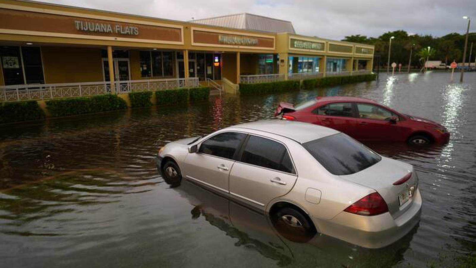
A slow-moving storm system supercharged by the El Niño climate cycle dumped unprecedented rainfall across South Florida on November 18, collapsing the roof of a synagogue, flooding residential streets, and shutting down major transportation arteries, according to an Associated Press report. Preliminary data compiled by the National Weather Service showed that Broward County absorbed up to 15.3 inches (39 centimeters) of rain over a 24-hour period ending Wednesday. The severe weather prompted local authorities in Broward County as well as the cities of Fort Lauderdale and Hollywood to declare states of emergency as the unseasonable deluge disrupted infrastructure ahead of the busy Thanksgiving holiday travel period.
Historic Deluge Disrupts Infrastructure and Infrastructure Safety
The convergence of heavy precipitation and atmospheric moisture has fundamentally scrambled Florida’s normal dry season, which typically spans from October through May. Alejandra Garcia, a meteorologist with the National Weather Service in Miami, explained that the natural El Niño warming cycle is actively dragging low-pressure systems toward the southeastern United States. In Fort Lauderdale, a downpour ending early Wednesday dumped 5.72 inches (14.5 centimeters) of rain, shattering a daily record of 1.8 inches (4.5 centimeters) that had stood since 1959.
The resulting water accumulation caused severe structural failures across the region. In Hollywood, the weight of the water collapsed the roof of Temple Sinai and caused widespread ceiling and hallway flooding at a local hospital. No injuries were immediately reported, but officials scrambled to respond to hundreds of emergency calls. Hollywood Mayor Josh Levy described the event as historically significant, noting that city services had fielded more than 300 calls overnight as stranded motorists and flooded residents sought help. Portions of Interstate 95 and the Florida Turnpike in Hollywood were impassable, blocked by high water and stalled vehicles.
Regional Impacts and Continuing Threats Across Coastlines
The severe weather disruption was not isolated to the Southeast. Concurrent storm systems battered the West Coast, where high winds and heavy downpours temporarily grounded flights at San Francisco’s airport, halted ferry services, and triggered localized flooding in wine country areas north of the city. In San Francisco, which recorded a daily record of 2.28 inches (5.8 centimeters) of rain, local fire departments responded to more than 300 weather-related calls concerning flooded thoroughfares, downed trees, and compromised electrical wiring.
As the South Florida system continues to evolve, forecasters warn that hazardous conditions will persist. The National Weather Service indicated that the threat along Florida’s Atlantic Coast could extend through Friday, with potential additional rainfall accumulations reaching up to 12 inches (30 centimeters). Furthermore, the National Hurricane Center in Miami is monitoring a developing low-pressure system near the northern Bahamas that carries the potential to evolve into a subtropical or tropical storm over the Southeast and mid-Atlantic coasts into the early days of the following week.
Emergency Measures and Next Procedural Steps
In response to the escalating crisis, school districts in Broward and Miami-Dade counties announced closures for Thursday to keep students and staff off hazardous roadways. Meanwhile, emergency management officials have issued warnings regarding prolonged travel disruptions along major East Coast transit corridors. Long-range forecasting models from the National Weather Service show that heavy rain risks will shift northward, threatening the Atlantic seaboard from Georgia and South Carolina through North Carolina, New York’s Long Island, and into New England as the holiday week approaches. Residents in low-lying zones remain under active advisories as municipal crews work around the clock to clear clogged drainage systems and assess infrastructure stability.