


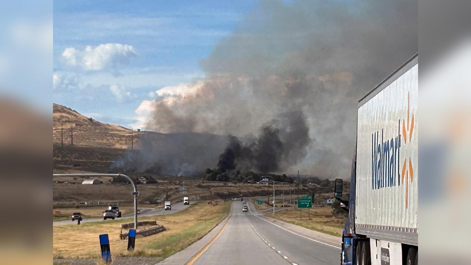
GARLAND, Utah (Azat TV) – A fast-moving wildfire in northern Utah’s Box Elder County forced emergency evacuations and the temporary closure of Interstate 15 on Friday evening, August 21, 2026, as dry vegetation and strong surface winds fueled rapid flame ignition across hundreds of acres. Officially named the Harley Fire, the blaze ignited around 5:00 p.m. local time near Harley Drive, positioned north of Tremonton and west of Garland. Within less than an hour, the fire expanded from an initial estimate of 75 acres to between 200 and 300 acres, threatening residential neighborhoods, power distribution lines, and municipal water infrastructure during a peak late-summer weekend travel period.
Rapid Spread Along Interstate 15 Corridor
The sudden outbreak triggered immediate traffic disruption along Interstate 15, a critical commercial and passenger highway connecting northern Utah to southern Idaho. State transport authorities and the Utah Department of Transportation (UDOT) initially shut down all traffic in both directions between mile markers 381 and 385 near 1000 North in Tremonton. Northbound lanes were reopened by 7:00 p.m. as emergency responders secured early access, and all main interstate lanes subsequently reopened after conditions stabilized along the roadway shoulder. However, local access corridors, including Canal Road (7600 West), remained closed to through traffic to allow uninterrupted access for suppression equipment and heavy emergency vehicles.
The timing of the fire compounded traffic challenges, occurring on one of the last Friday evenings of the late-summer travel season when vehicular density along Interstate 15 is exceptionally high. State highway patrol troopers and local road crews redirected thousands of motorists onto secondary arterial routes while fire crews deployed engine companies to protect nearby structural assets along the highway right-of-way.
Evacuations and Local Infrastructure Impacts
Municipal emergency agencies moved swiftly to address threats to nearby residential structures. The Garland Fire Department issued mandatory evacuation orders for all households along Harley Drive, resulting in the direct evacuation of at least 10 homes. Authorities simultaneously placed residents in the nearby Radio Hill area under “READY” status within the “Ready, Set, Go!” wildland emergency framework, instructing households to assemble essential emergency supplies and prepare for immediate departure if wind patterns shifted the fire perimeter toward their neighborhood.
An emergency temporary shelter and evacuation center was established at the Garland Armory, located at 72 North Main Street, where local fire officers and volunteer relief personnel coordinated emergency assistance, shelter, and logistical information for displaced residents.
The fire’s proximity to regional distribution networks forced utility operators and emergency personnel to cut electrical power across broad portions of Box Elder County to prevent electrical hazards, protect transmission equipment, and facilitate aerial and ground suppression work. The precautionary shutdown caused widespread power outages throughout both Garland and Tremonton. Fire official Kelly Wickens confirmed that electrical service to the twin communities would likely remain offline until crews could safely inspect, repair, and reactivate transmission lines running through the burn scar. Local public safety authorities strictly urged the public to stay clear of the active fire ground, highlighting that unauthorized spectator presence and civilian drone flights severely hinder tactical air operations and heavy bulldozer line construction.
Multiple Wildfires Strain Box Elder County Resources
The Harley Fire represents the third significant wildland blaze to ignite in Box Elder County within a single 24-hour window, placing heavy logistical demands on regional firefighting units and interagency wildland task forces. Early Friday morning before 6:00 a.m., the Salt Wells Fire erupted in Hansel Valley, an area slated for the planned Stratos data center and energy campus. Driven by dry fuels, the Salt Wells Fire burned approximately 585 acres before crews successfully established a perimeter, reaching 60 percent containment by Friday afternoon with no structures compromised. State fire investigators later confirmed that the Salt Wells Fire was caused by human activity.
A day prior, on Thursday afternoon, the Little Mountain Fire ignited south of Tremonton and north of the Bear River Migratory Bird Refuge. That blaze spread across 560 to 600 acres of brush and grass before rapid ground response brought it to 75 percent containment by Friday. The simultaneous management of three distinct fires along key infrastructure corridors in northern Utah has highlighted the heightened fire risk across the Great Salt Lake Basin, where severe late-summer vegetation dryness combines with sudden wind shifts to create volatile wildland conditions.
Environmental Conditions and Containment Outlook
Ground crews and heavy equipment operators focused initial containment efforts on establishing physical barriers along the Harley Fire’s perimeter. By late Friday evening, bulldozer teams had completed a containment trench around the outer boundary of the burn area, providing a crucial buffer against spot fires. Despite the dozer line, official containment remained listed at 0 percent as fire managers evaluated potential breaches caused by forecasted thunderstorm activity. Approaching weather fronts brought concerns of erratic gusty winds and dry lightning, which could push embers across existing lines into unburned fuels.
Fire officials confirmed that the Harley Fire was human-caused, though specific details regarding the exact ignition source remain under active investigation by state and local law enforcement. As containment operations continue into the weekend, emergency management officials emphasize the ongoing vulnerability of rural infrastructure, urging residents in adjacent fire zones to remain vigilant and monitor official emergency broadcasts for updated evacuation orders and power restoration schedules.