


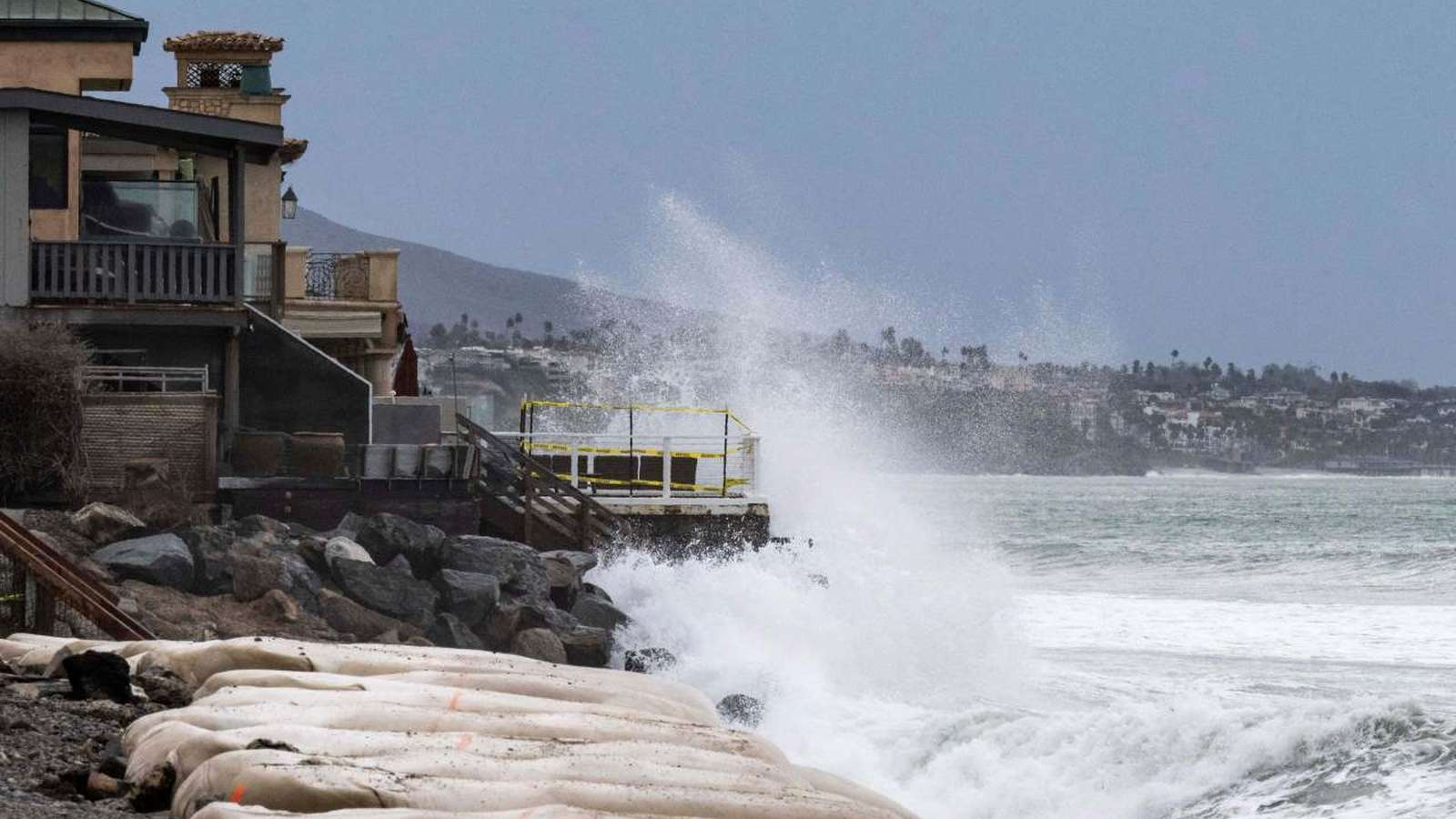
LONG BEACH (Azat TV) – Remnants of Tropical Storm Rachel brought powerful surf and elevated water levels to the Long Beach Peninsula, damaging oceanfront residences, tearing apart sections of the 1920s-era boardwalk, and prompting emergency evacuations, according to the Santa Monica Observer (Santa Monica Observer).
Destruction Along the Peninsula
The Peninsula, a narrow sandspit at the southeast end of Long Beach that separates Alamitos Bay from the Pacific Ocean, experienced severe coastal erosion as heavy waves overtopped and fractured the protective bulkhead. Damage was particularly acute between the 64th and 66th Places along Seaside Walk, where powerful surf tore away portions of the historic boardwalk and flooded residential streets. ABC7 reported that some structures suffered exposed foundations, cracked walls, and partial structural failures as ocean water pushed directly into living spaces (ABC7).
City building inspectors red-tagged nine buildings covering 13 addresses, declaring them unsafe for entry due to imminent collapse risks, while an additional building received a yellow tag restricting occupancy. Mandatory evacuation orders remained in effect for homes between the 64th and 66th Places on Seaside Walk, alongside evacuation warnings for surrounding blocks.
Emergency Response and Infrastructure Protection
Emergency crews deployed heavy machinery to stabilize the eroding shoreline. Workers positioned 3,000-pound sandbags via crane to reinforce the compromised bulkhead and protect vulnerable foundations. The city also distributed thousands of sandbags to residents and worked to pump standing water from flooded streets.
Long Beach fire officials emphasized that public safety remains the top priority, urging residents to stay away from red-tagged structures despite the emotional toll of being locked out of their homes. Assistant Fire Chief Jake Heflin noted that the city is accelerating immediate sand replenishment efforts, planning to truck in tens of thousands of cubic yards of sand followed by a larger dredging project.
El Niño Context and Regional Vulnerability
Meteorological factors compounded the severity of the event. The high surf combined with elevated water levels driven by El Niño ocean patterns, a Kelvin wave, and astronomical tides. Although the National Weather Service noted that the most extreme alignment of peak swell and wind did not fully materialize, the persistent battering caused significant damage across the waterfront.
Local authorities have framed the event as an early warning for the broader region. With the Pacific entering an active El Niño cycle, officials are encouraging coastal property owners to secure insurance assessments and prepare for potential future storms before heavier precipitation arrives later in the season.