


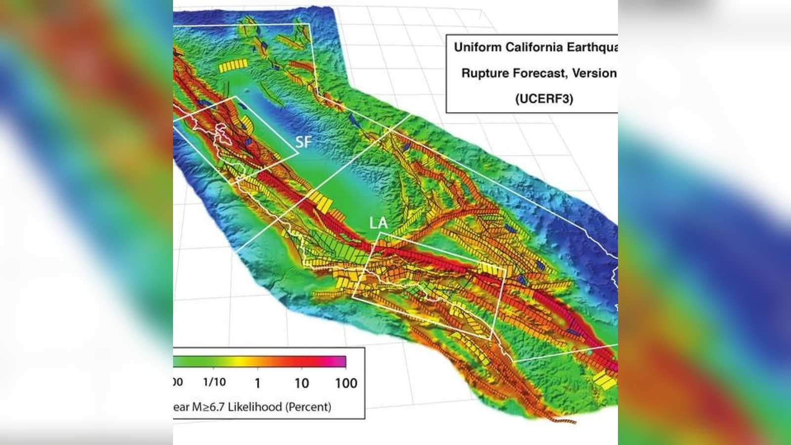
California’s San Andreas Fault system is under greater tectonic strain than at any point in the past millennium, according to two independent scientific investigations published this year. The separate research projects, which analyzed opposite geographic ends of the fault system, indicate that seismic hazards for nearly 30 million residents in Southern and Northern California may be significantly underestimated by existing state risk models.
The findings combine advanced computer modeling of historical stress transfer with high-precision radioactive isotope dating of rock formations. Together, they depict a fault system late in its earthquake cycle, where key structural junctions are approaching physical thresholds capable of triggering simultaneous, multi-fault ruptures.
This report draws on information published by sundayguardianlive.com.
Stress Spikes at the Southern ‘Earthquake Gate’
The first study, led by geophysicist Liliane Burkhard of the University of Bern and published in the Journal of Geophysical Research: Solid Earth, focused on the southern section of the San Andreas and the adjacent San Jacinto Fault Zone. Using dynamic numerical simulations to reconstruct 1,000 years of seismic history, the research team found that stress accumulation at the San Jacinto–San Bernardino segment exceeds any level recorded throughout the entire simulated timeframe. The neighboring Mojave South section of the San Andreas was also found to be carrying exceptionally high load levels.
Burkhard’s team highlighted the critical role of Cajon Pass, a narrow mountain gap northeast of Los Angeles where the San Andreas and San Jacinto faults converge to within 1.5 kilometers of each other. Seismologists refer to such narrow structural junctions as “earthquake gates,” because an active rupture originating on one fault can cross the boundary and ignite a joint rupture across both systems.
Historical records underscore the variable behavior of this tectonic gateway. The massive 1857 Fort Tejon earthquake stopped short at Cajon Pass, remaining confined to a single fault zone. Conversely, evidence suggests that the 1812 Wrightwood earthquake successfully jumped the gap, triggering simultaneous ruptures along both systems. According to Burkhard, the relative stress conditions between the two systems are currently entering the specific range historically associated with cross-fault rupture events.
Northern Fault Slip Rates Challenge Long-Held Models
While Burkhard’s team examined stress transfer in Southern California, geologist Kim Blisniuk of San José State University investigated long-term slip dynamics in Northern California. Her research team focused on a segment of the northern San Andreas running beneath the Santa Cruz Mountains near Saratoga, south of San Jose. Their findings were reported by the San Francisco Chronicle.
Using beryllium-10 cosmogenic exposure dating—a method that measures how long displaced rock surface formations at Sanborn County Park have been exposed to cosmic radiation—Blisniuk calculated fault displacement rates spanning approximately 10,000 years. The measurements challenge a long-standing seismic assumption that tectonic plate motion tapers off along this segment as it extends south. Instead, the data demonstrates that the fault section has maintained a consistently high displacement rate over ten millennia.
Blisniuk emphasized that the revised figures represent a structural update to baseline scientific models rather than a sudden change in physical movement. However, she noted that the accelerated historical slip rate confirms the segment is deep into its strain-accumulation cycle, making a major rupture highly likely within current human lifespans.
Infrastructure Risks and Emergency Preparedness
The implications of a joint or multi-fault rupture extend well beyond immediate localized shaking. A benchmark 2008 U.S. Geological Survey (USGS) disaster scenario calculated that a single magnitude 7.8 earthquake on the southern San Andreas could result in approximately 1,800 fatalities and $213 billion in economic damage. A combined rupture crossing the Cajon Pass threshold, estimated between magnitude 7.4 and 7.8, could inflict wider spatial devastation due to the concentration of critical lifelines passing through the mountain pass.
Cajon Pass serves as a vital infrastructure corridor hosting Interstate 15, major transcontinental freight railway lines, high-voltage electricity transmission lines, fiber-optic communications, and regional natural gas pipelines. A severe surface displacement event in this single bottleneck could disrupt commerce and energy supply chains across the Southwestern United States.
Neither study attempts to predict the exact timing of a future event, as short-term earthquake forecasting remains beyond current scientific capabilities. State officials at the California Governor’s Office of Emergency Services (Cal OES) continue to urge residents to review household earthquake readiness. Recommended measures include securing heavy furniture, maintaining a minimum three-day supply of water and non-perishable food per person, identifying manual gas shut-off valves, and establishing emergency family communication plans that do not rely on cellular networks. Residents can also assess localized fault hazard zones using the California Geological Survey’s interactive EQ Zapp portal.