


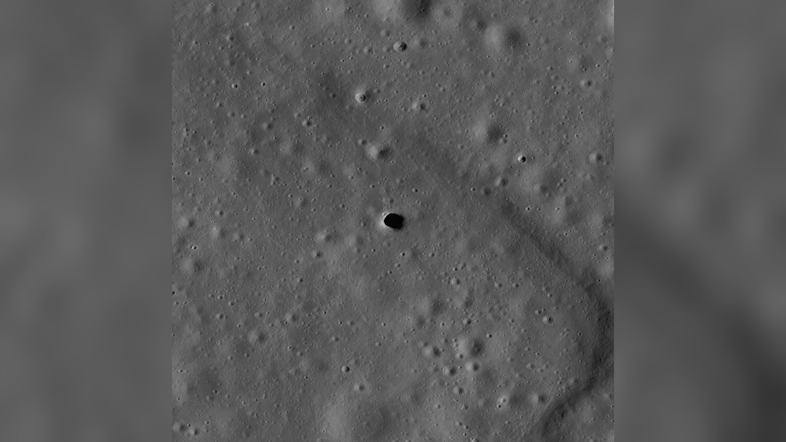
Investigating the Marius Hills Pit from the Surface
NASA has selected the Geophysical Instruments for Marius Lunar pit Investigation (GIMLI) project, led by the Planetary Science Institute (PSI), to determine whether the Marius Hills Pit on the Moon opens into an extensive underground cave system or lava tube. Until now, this prominent geological feature has been studied exclusively from lunar orbit. The depression spans roughly 300 feet across and plunges up to 150 feet deep, serving as a prominent candidate for a collapsed volcanic skylight.
The GIMLI project will deploy a specialized lunar rover equipped with advanced instrumentation to examine the site directly from the lunar surface. According to Futurism, the initiative is funded through NASA’s Payloads and Research Investigations on the Surface of the Moon (PRISM) program and will reach the lunar surface aboard a commercial lander provided by the Commercial Lunar Payloads Services (CLPS) initiative.
Beneath its pock-marked, craggy exterior, the Moon is thought to harbor a network of caves and tunnels from its volcanic past. Now, NASA has selected a mission to go investigate a promising window into our space rock’s subterranean secrets. Gaping up at outer space, as if mugging for the orbital satellite cameras, is the Marius Hill Pit, a hole on the lunar surface that’s thought to be up to 150 feet deep and up to 300 feet across. Scientists believe it’s an example of a skylight — the collapsed roof of an underground lava tube, which forms a circular aperture in the ground. If the feature is indeed a skylight, it could give scientists a peek at the Moon’s volcanic history. But scientists are also intrigued by the possibility of using these underground cavities as shelters for astronauts, or even the location of lunar bases. Until now, the hole has only been investigated from orbit. The Geophysical Instruments for Marius Lunar pit Investigation (GIMLI) aims to do so from the ground.
Advanced Instrumentation and Scientific Goals
To detect potential subsurface voids, the research team will combine active-source seismic sensors, ground-penetrating radar, and a gravimeter to measure gravitational field variations. High-resolution cameras will also capture detailed imagery of the exposed pit walls and surrounding terrain. PSI Associate Director Than Putzig noted that combining these active seismic methods with radar and gravity measurements represents a return to active-source seismic surveying on the Moon for the first time since the Apollo missions.
Honeybee Robotics, a subsidiary of Blue Origin, will construct much of the mission equipment, including the seismic system, gravimeter, and cameras, while managing payload integration. Additional international collaboration includes ground-penetrating radar provided by the Norwegian Space Agency, alongside co-investigators from Boise State University, Johns Hopkins University, the Lunar and Planetary Institute, and the University of Oslo.
To determine if the hole opens up into a larger cave, the scientists at the Planetary Science Institute will equip a lunar rover with specialized instruments, including ground penetrating radar, seismic probes, and a sensor that measures the strength of the gravitational field called a gravimeter, to investigate it from the Moon’s surface. The rover will also use cameras to image the exposed portions of the pit. “Confirming a substantial lava tube would give us an insight into how volcanism operated on the Moon,” said Gareth Morgan, a Planetary Science Institute senior scientist and deputy principal investigator on the GIMLI program, in a statement.
The area near the MHP has a rich history of volcanic activity, according to a PSI release, with exposed layers of regolith and lava flows. Studying these layers could reveal how lava once flowed across the Moon. PSI Director and CEO Amanda Hendrix noted that Than and his team are taking a scientific question studied from orbit and developing a way to investigate it directly on the Moon, highlighting the ambitious nature of the planetary science program.
Implications for Volcanic History and Future Habitats
Confirming a substantial lava tube would provide critical empirical data on how basaltic volcanism operated across the lunar landscape. PSI Senior Scientist and Deputy Principal Investigator Gareth Morgan emphasized that terrestrial analogies help researchers interpret lunar history through preserved volcanic strata. Furthermore, subsurface cavities offer compelling long-term utility for future exploration.
Because the Moon lacks a substantial atmosphere, its surface is constantly exposed to harsh solar radiation and extreme temperature fluctuations. Establishing shelters within natural subterranean caverns could provide a shielded environment for future astronauts and lunar bases, making direct investigation of the Marius Hills Pit a vital step for both planetary science and human spaceflight infrastructure.
The mission could still produce important discoveries even if researchers find no cave or lava tube. Its measurements could help address another major question: How did the Marius Hill Pit form? By examining the material surrounding and beneath MHP, scientists could gain new clues about the pit’s origin as well as the geology and volcanic history of the wider region. The team also plans to study more than the possible underground structure. The surrounding area has experienced a long history of volcanic activity, and the walls of MHP expose layers of regolith and lava flows that normally remain buried. Examining these layers could show how lava once moved across and beneath the lunar landscape and whether individual eruptions were separated by long intervals.
Lunar pits are valuable not only because their walls expose otherwise hidden geology. Any underground spaces connected to them could also preserve evidence of the volcanic processes that helped shape the Moon. As NASA prepares for a new era of lunar exploration, one mysterious hole may give scientists their first real glimpse into what the Moon has been hiding all along, bridging the gap between historical orbital observations and physical, ground-level analysis.